Hydraulics, hydrology and hydrogeology

Detection of gully erosion using the method of Global Navigation Satellite Systems in the Myjava – Turá Lúka

This paper shows the partial outcomes of a study focused on monitoring gully erosion in the Myjava river basin. The study showed the progress of dynamic changes in gully erosion in the location of Turá Lúka using various surveying techniques from 2014 until present. The study shows that selection of the surveying technique depends on various criteria and the aims of the task, where each possesses advantages and disadvantages. In the case of determination of the parameters of gully erosion (volume, length, and position), one of the suitable surveying techniques is Terrestrial Laser Scanning (TLS) as well as Unmanned Aerial Vehicles (UAV), which results in a point cloud. Measurement using Global Navigation Satellite Systems (GNSS) with a GPS device is sufficient for assessing gully erosion in transverse profiles, more complex sections, or in places with built anti-erosion and stabilization dams in a gully. This assumption was confirmed based on results from field measurements of an erosion gully by GNSS technology in 2017–2021. Evaluation of the results is given in this article. The given method of mapping the erosion gully was chosen for the need for detailed profile evaluation of previously identified critical sections (transverse profiles) of the monitored erosion form based on field surveying and area scanning and for simple data processing. The simplicity of this method due to the type of task, staffing, time, and volume of data predetermines and confirms the suitability of its selection for use under the given circumstances. When choosing this measuring technique, the requirements are easy access to the measuring point and a good satellite signal for GPS devices influencing the accuracy of the measurement concerning the surrounding vegetation. Sufficient testing and comparison of available surveying techniques make it possible to efficiently and realistically select suitable effective technology for monitoring erosive forms in the landscape for a predefined purpose. Contributions of this type will help researchers of similar tasks in decision-making when choosing the most suitable landscape surveying technology.

Changes in precipitation and runoff in river basins in the Czech Republic during the period of intense warming

The basic meteorological variables that affect the hydrological regime are atmospheric precipitation and air temperature. Both fluctuate not only in the short term and in the annual cycle, but also in the long term. Long-term changes in both of these variables have the character of periodic fluctuations around the mean values. Since about 1980, there has been a systematic increase in air temperature in the Czech Republic. This article provides information on how the climate fluctuations that this change brings affect the precipitation and runoff regime in our territory.

Occurrence of pesticides in the Punkva river

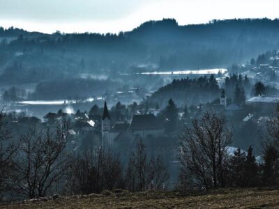
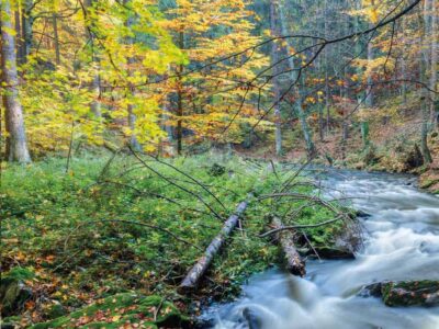
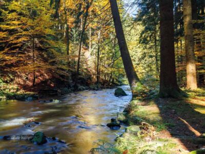
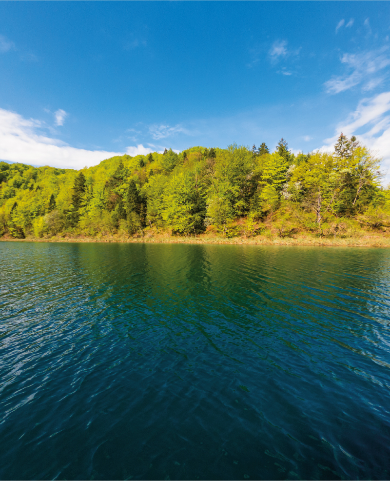
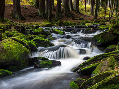
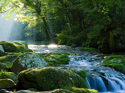
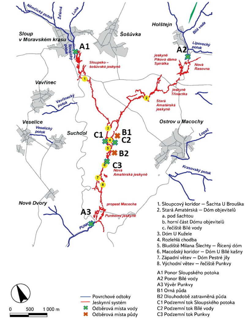
The Moravian Karst is the largest and most karstic area in the Czech Republic, and, as such, it is a protected landscape area (PLA). The karst area occupies a strip of Devonian limestone north of Brno. The north part of Moravian Karst is drained by the river Punkva and its headwaters. One of the biggest cave systems in central Europe is located there, Amaterska cave, which is more than 40 km long.
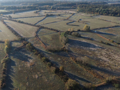
Despite the strict protection measures that are in place in the PLA, the presence of pollutants and potentially hazardous substances has recently been detected in the Punkva river and its catchment. The sources of this pollution are found both within the territory of Moravian Karst PLA and in the river´s catchment, and they are related to anthropogenic activities and land use. This article focuses on the occurrence of pesticides, especially triazine and azole pesticides and their polar metabolites. In 2020, a new significant contaminant, 1,2,4-triazole, a common relevant metabolite of azole pesticides, was found at the site concerned. These substances can have fatal effects not only on the endemic organisms living in the Moravian Karst, but they can also endanger human health because the local groundwater is used as a source of drinking water. Thanks to the studies carried out, the protection zones around the cave system have been extended, reducing the negative effects of agricultural activities in the area of interest.

Monitoring changes in the landscape development on the northeastern edge of the Hřebeny Mountains with a focus on wetlands

This article deals with changes in wetlands on the north-eastern edge of Hřebeny Mountains in the last 180 years. It assesses the dynamics of these landscape elements in space and time. The cadastral areas of Čisovice, Řitka, Kytín, and Nová Ves pod Pleší were selected, with a total area of 3,785.57 ha. Analysis was carried out on the basis of the Imperial obligatory prints of the maps of the stable cadastre from 1840, an orthophotomap, and field research from 2020; it distinguished wetlands in the monitored area into continuous, extinct and new. The background data were processed in ArcGIS software, version 10.7.1. The area of wetlands decreased from 289.34 ha in 1840 (7.6% of the monitored area) to 39.26 ha in 2020 (1.04% of the monitored area). Based on the study of available data, three types of wetland habitats were classified: wet meadows, wet meadows with woody plants, and ponds.

Comparison of hydrological characteristics of M-day discharges of the reference period 1981–2010 and the considered reference period 1991–2020

According to the Czech technical standard ČSN 75 1400 Hydrological data of surface waters, M-day discharges are a part of the Basic hydrological data [1]. The values of M-day discharges in water gauging stations are derived from time series of observed mean daily discharges over a defined reference period. The reference period 1981–2010 is currently used for design purposes [2]. With the end of the second decade of the 21st century, a change in the reference period for 1991–2020 is being considered. In the past, the Czech Hydrometeorological Institute (CHMI) provided hydrological data for the reference periods 1931–1940, 1931–1960, and 1931–1980.

Zero isochion in the framework of geomorphological regions in Czechia: its extraction from the MODIS imagery and its dynamics

Since December 2012, during every winter season, the altitude of the zero isochion (snowline) has been determined at the Czech Hydrometeorological Institute for the purposes of operational hydrology. The reason is the estimation of the amount of water stored in snow cover, which is inevitable activity for Czech hydrologists who naturally want their forecasting models to give relevant results. In order to get a better idea about current spatial distribution of snow cover in Czechia, the information on the zero isochion has been extracted from the MODIS imagery coming from the Terra satellite.

Practical examples of using GIS in hydrology at the Czech Hydrometeorological Institute

GIS technologies are widely used in the Hydrology Department of the Czech Hydrometeorological Institute (CHMI). The processing of geospatial data, which are used in hydrology for analytical tasks, and the development of GIS technologies in the last two decades have contributed to the spread of GIS in the CHMI practice. The use of GIS tools is shown in four examples. The first one focuses on the creation of GIS data. The second example concerns the preparation of input source data for the derivation of the hydrological characteristics of M-day discharge, which, according to Czech Standard 75 1400 Surface water hydrological data, are among the basic hydrological data. The third example describes the use of GIS in the preparation of hydrological assessments according to the above-mentioned standard (75 1400), which usually result in M-day or N-year-flood discharges in a specified profile of a certain watercourse. The fourth example focuses on the use of GIS in operational hydrological service, specifically in the development of the Flash Flood Indicator, which determines the level of risk of flash flood formation or occurrence based on current land saturation and radar rainfall estimates.

Mini-JET device as a tool for determination of soil erodibility characteristics

The article describes a method for determining the erodibility of incohesive agricultural soils by means of the critical shear stress measuring. The “Jet Erosion Test” (JET) was used to determine the critical shear stress. The mea-
surement was performed using a modified Mini-JET device. The device is very suitable for field measurements, because it is small, light, requires a relatively small amount of water, and can be operated by single person. The principle of measuring the critical shear stress of the soil is based on monitoring the rate of erosion crater formation by the action of a water jet of known kinetic energy. Based on the erosion crater development, the erosion parameters of the soil, such as the critical shear stress and the erodibility coefficient, can be calculated.

Problematics of archive map data interpretation, specifically the wetland habitats

The article presents available on-line archive maps from the websites of the Archive of the Surveying Office and the Geoinformatics Laboratory of the J. E. Purkyně University, that provide an overview of the historical wetland habi-
tats location. The main research question is to find out the potential use of historical maps for the identification of the historical wetlands in the Czech Republic and the evaluation of various interpretations of wetland habitats based on these sources. Examples of wetlands on historical map data in the upper part of the Výrovka River basin are presented.

A retrospective view of the Šumperk water supply system up to the 1960s

The article focuses on the water industry sector. It deals with the development of drinking water supply in Šumperk town from the Middle Ages to the 1960s. According to the water supply network development, the text is structured into individual chapters, focusing on the interesting period of the late 19th century, when a municipal water plant was established. The water plant was also the first company managed by the city council at its establishment. It was an excellent good practice example for similar towns in the Czech lands, both technologically and operationally. Subsequent chapters focus on expanding the water supply network, reservoirs, and intake areas, which had to be sized for the increasing water consumption associated with the city‘s dynamic development in the late 19th and first half of the 20th century. The final chapter summarises the development of the municipal waterworks project from 1945 until the year when the town of Šumperk was connected to the water intake sources from the Kouty-Šumperk group water supply system. The paper is an inspiring retrospective look into the history of the municipal water supply. It can also be a helpful comparison with the current state, building possibilities and limits of the water supply infrastructure.

Centrum Voda

 This article is available in Czech only. For translation or more information on this topic, please contact author. Hlavní zaměření: Adaptace společnosti a vodních ekosystémů na změny klimatu Centrum Voda je výzkumný projekt, který hledá řešení problémů vyplývajících z klimatické změny a jejího vlivu na vodní poměry. Snažíme se nalézat odpovědi na základní otázky, jestli dokážeme zajistit dostatek… Read more »

Drought in the Upper Metuje Basin in 2014–2019

In the years 2014–2019, there was a historic drought in the Czech Republic. The Department of Hydrology and Hydrogeology of the T. G. Masaryk Water Research Institute has been carrying out long-term hydrological and hydrogeological observations in the upper Metuje basin where this drought manifested itself significantly. The upper part of the catchment area of the Metuje River is located in the Police Cretaceous basin geological formation.

The analysis of agricultural landscape development shown on selected cadastral districts in the upper part of the Výrovka River basin

V tomto článku jsou ve vybraných katastrálních územích s převažující plochou zemědělské půdy porovnávány aktuální land use a struktura krajiny s historickým stavem z podkladů Císařských povinných otisků stabilního katastru. Jsou zde nastíněny možnosti využití analýz historického vývoje krajiny ke krajinné obnově v zemědělských oblastech, zejména s ohledem na obnovu mokřadních ekosystémů a revitalizaci vodních toků.

Testing of a prototype separation device designed for rainwater treatment

Článek shrnuje poznatky získané v rámci řešení výzkumného projektu „Technologie separace specifických polutantů ze srážkových vod“ (TH03030223), který se zabýval čištěním srážkových vod ze zpevněných ploch a komunikací zatížených nerozpuštěnými látkami (NL), polycyklickými aromatickými uhlovodíky i těžkými kovy. Projekt si kladl za cíl vyvinout účinnou technologii, která by uvedené polutanty ze srážkových vod separovala.

Grey water footprint of pollution discharged from wastewater treatment plants in the Czech Republic registered in the water balance in the period 2002–2018 – data set

Koncept vodní stopy byl představen v roce 2002 [1] a dnes je jedním z rozšířených nástrojů pro hodnocení udržitelnosti užívání vodních zdrojů [2]. Vodní stopa patří do rodiny environmentálních stop [3], které umožňují podívat se na problémy užívání přírodních zdrojů z jiné perspektivy. Šedá vodní stopa je kvalitativní ukazatel převádějící vypouštěné znečištění na objem vody potřebný k jeho naředění na koncentrace neškodné pro životní prostředí [4].

Hydrological balance in selected watersheds of the Czech Republic with focus on drought period 2015–2019

The contribution is aimed to the determination and assessment of a hydrological balance at selected watersheds in Czech Republic during the dry period 2015–2019. Hydrological balance was processed in gauging stations of watershed Blatný stream, Lomnice, Skalice, Žehrovka, Javorka, Cidlina, Botič and upper Sázava river using data from Czech hydrometeorological institute. Monthly, long-term monthly and annual values were calculated for precipitation, runoff and evapotranspiration. Results were compared across the selected watersheds and with long-term period 1981–2010. Runoffs from watersheds were compared with gauging average discharge of an entire observation period.

The alternative detemination of R-factor (Rainfall erosivity factor) in the Husí Creek catchment

Hodnocení erozní účinnosti deště je v současnosti těžištěm výzkumu v oblasti stanovení erozního ohrožení půdy. V rámci empirického modelování pomocí modelů rodiny USLE (the Universal Soil Loss Equation) je erozní účinnost deště reprezentována tzv. R faktorem, jehož hodnotu lze stanovit řadou doporučených postupů. Tento článek představuje možné alternativní způsoby určení hodnoty R faktoru na základě ročních a měsíčních sum srážkových úhrnů.

Quantification of rill erosion using contactless methods

S překotným vývojem v oblasti geoinformačních a komunikačních technologií se objevují nové možnosti mapování a kvantifikace erozních procesů způsobených přívalovými srážkami. Pro získání relevantních výsledků je důležitá kvalita, hustota a rozsah vstupních dat. Rychlý a poměrně levný sběr přesných geodat umožňují bezpilotní letecké prostředky (UAV – z anglického Unmanned Aerial Vehicle). S využitím metod digitální fotogrammetrie je možné z pořízených leteckých snímků rekonstruovat morfologii terénu odpovídající času měření.

Preservation of drinking water demand from water reservoirs in climate change conditions

This study presents interim results of an evaluation of a potential climate change impact on the preservation of drinking water demand provided by water reservoirs in the timeframe of the year 2050. Hydrological and water sources and demands balance procedures have been applied, including modelling of the storage ability of water resources and water supply systems.

Sensitivity analysis of selected input parameters of the numerical model HEC-RAS in and floodplain flow calculations

This article is available in Czech only. For translation or more information on this topic, please contact author.   Souhrn Hydraulické výpočty proudění vody v korytech vodních toků a záplavových územích se v současné inženýrské praxi provádějí primárně s použitím 1D, 2D a spřažených 1D/2D numerických modelů. Matematický model je v případě zmiňované 2D schematizace… Read more »

Prediction model of water quality around Prague

This article is available in Czech only. For translation or more information on this topic, please contact author.   Souhrn V poslední době se velmi diskutuje – a to nejen mezi odbornou veřejností – o dopadech změny klimatu na vodní režim v přírodní krajině. Řešení OP Praha – pól růstu se zaměřilo i na krajinu… Read more »

Adaptation of towns and municipalities to floods and drought

This article is available in Czech only. For translation or more information on this topic, please contact author.   Souhrn Realizace komplexních adaptačních opatření je v posledních letech významným trendem ve všech velkých městech a obcích Evropy. Potřeba přizpůsobení se změně klimatu, vyznačující se střídáním krátkých a intenzivních povodňových epizod [1] a dlouhých období sucha,… Read more »

History and future development of rainfall-runoff characteristics on the outskirts of Prague

This article is available in Czech only. For translation or more information on this topic, please contact author.   Souhrn Tento příspěvek prezentuje studii vývoje srážkoodtokových charakteristik v šesti povodích na okraji Prahy od roku 1920 s výhledem do roku 2050. Kvůli neexistujícímu dlouhodobému monitoringu bylo hodnocení provedeno prostřednictvím srážkoodtokového modelování v prostředí HEC-HMS. Klíčovým… Read more »

Groundwater formation in urban areas regarding peripheral parts of Prague

Groundwater is an integral part of the hydrosphere and hydrological cycle in a healthy landscape, which is better able to withstand hydrological extremes such as floods or prolonged drought. The main source of groundwater is precipitation. There are a number of barriers for infiltration in urban areas – urban and industrial buildings, as well as increasing areas with impermeable surfaces. The aim of the paper is to draw attention to the importance of groundwater in the urban landscape and to possible measures to support the infiltration of precipitation.
The research took place in the territory of outer Prague, where there is an intensive expansion of the built-up area, which is accompanied by a lower infiltration of precipitation, compared to the open landscape. Based on the evaluation of pedological, geological and hydrogeological conditions of the area, a methodology for evaluating the suitability of the area for infiltration was developed. Based on it, two types of maps were created: an infiltration potential map evaluating primarily the permeability of the soil and rock environment, and an infiltration capacity map, in addition emphasizing the size of the free storage volume for infiltrated water. Maps are available for viewing in the map application on the project website heis.vuv.cz/projekty/praha-adaptacniopatreni.

Project CZ.07.1.02/0.0/0.0/16_040/0000380 “Analysis of adaptation measures to mitigate impacts of climate change and urbanization on the water regime in the area of external Prague”

 This article is available in Czech only. For translation or more information on this topic, please contact author. Rádi bychom vás seznámili se základními údaji o projektu, který byl řešen v období 2018–2020 v rámci operačního programu Praha – pól růstu. Za tímto textem jsou pak uvedeny články zabývající se již specifickými tématy, jež byla… Read more »

Surface Water Status Assessment for the Third Cycle River Basin Management Plan of the Czech Republic

The aim of this article is to acquaint the professional public with the summary results of the assessment of chemical status and ecological status/potential of surface water bodies “river” and “lake” categories in the Czech Republic for 2016–2018.
This assessment is one from the basis for preparation of the Third River Basin Management Plan (2021–2027) at all its levels: sub-basin plans, national plans, and international plans of the Elbe, Danube, and Oder river basin districts.

Evaporation from TGM WRI evaporimeter stations

Evaporation from water surface significantly affects the overall hydrological balance of a river basin. Direct measurement of evaporation is complicated and not as common as the measurement of other quantities (e.g. precipitation or air temperature). Therefore, evaporation is often determined using formulas requiring available meteorological quantities as input data.

Growth and decline of fishery in Poděbrady and Nymburk Estates from the point of view of historical hydrology

This contribution presents a current occurrence of drought periods and declines of fishponds (including entire fishpond systems), in Poděbrady and Nymburk counties. Such relation is not straightforward, when we consider fishponds as reservoirs of water and energy.

Fishponds in Hracholusky Reservoir drainage basin – results from screening

Series of 16 fishponds was monitored as a part of a drainage basin of Hracholusky reservoir, which is subject of a recovery project. All the fishponds were eutrophic – hypertrophic due to wastewaters from villages and little cities (including overflows from sewers) and/or due to too intensive production of “hunters ducks” – the phenomenon that is rarely mentioned.

Characterization of an artificially generated rainfall used for a soil erosion research

Vodní eroze půdy se běžně studuje v laboratořích, experimenty bývají založeny na uměle generovaných srážkách s využitím dešťových simulátorů. Typicky je vyhodnocován vliv různých faktorů, jako jsou intenzita nebo úhrn srážky, půdní charakteristiky, zpracování půdy, posklizňové zbytky nebo sklon a délka erozní plochy na erozi.

Update of empirical relationships for calculation of free water surface evaporation based on observation at Hlasivo station

Evaporation from free water surface is one of the essential components of water circulation in nature and significantly affects the overall water balance of the catchment. Due to the complicated direct measurement, it is often calculated from formulas that require available meteorological variables as input data.