Detection of gully erosion using the method of Global Navigation Satellite Systems in the Myjava – Turá Lúka
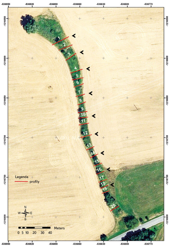
This paper shows the partial outcomes of a study focused on monitoring gully erosion in the Myjava river basin. The study showed the progress of dynamic changes in gully erosion in the location of Turá Lúka using various surveying techniques from 2014 until present. The study shows that selection of the surveying technique depends on various criteria and the aims of the task, where each possesses advantages and disadvantages. In the case of determination of the parameters of gully erosion (volume, length, and position), one of the suitable surveying techniques is Terrestrial Laser Scanning (TLS) as well as Unmanned Aerial Vehicles (UAV), which results in a point cloud. Measurement using Global Navigation Satellite Systems (GNSS) with a GPS device is sufficient for assessing gully erosion in transverse profiles, more complex sections, or in places with built anti-erosion and stabilization dams in a gully. This assumption was confirmed based on results from field measurements of an erosion gully by GNSS technology in 2017–2021. Evaluation of the results is given in this article. The given method of mapping the erosion gully was chosen for the need for detailed profile evaluation of previously identified critical sections (transverse profiles) of the monitored erosion form based on field surveying and area scanning and for simple data processing. The simplicity of this method due to the type of task, staffing, time, and volume of data predetermines and confirms the suitability of its selection for use under the given circumstances. When choosing this measuring technique, the requirements are easy access to the measuring point and a good satellite signal for GPS devices influencing the accuracy of the measurement concerning the surrounding vegetation. Sufficient testing and comparison of available surveying techniques make it possible to efficiently and realistically select suitable effective technology for monitoring erosive forms in the landscape for a predefined purpose. Contributions of this type will help researchers of similar tasks in decision-making when choosing the most suitable landscape surveying technology.