Landscape changes in the upper part of the Výrovka river basin from a water management perspective
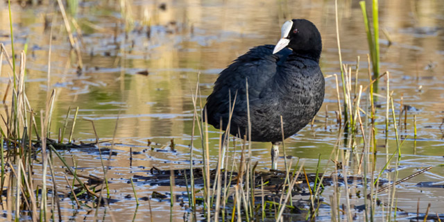
This article presents landscape changes in the upper part of the Výrovka river basin using a comparison of historical and current maps and or-thophotomaps, including verification of the current state of the landscape. On the map of the 2nd Military Mapping, 22 water bodies (ponds) with a total area of 57.53 ha were mapped. On the current map, 71 water bodies with a total area of 42.48 ha were recorded. Furthermore, significant changes in the location of watercourses were recorded; they were deepened, straightened, and their floodplains were drained. It is clear from the comparison of the map documents that these changes mainly occurred due to the intensification of agricultural use of the landscape.
The pond system on the Bečvárka river
The article presents the pond landscape development in the Bečvárka river basin based on the interpretation of archival and current maps, including verification of the current state of pond locations. Eleven ponds with a total area of 65.28 ha were recorded on the map of the 2nd Military Mapping. Sixteen ponds with a total area of 76.64 ha were recorded on the current map. The current ponds’ total area is approximately 11 ha larger than the area of the historical ponds. This is despite the fact that almost all individual historical ponds had an area larger than at present. One of the main reasons for this is the later construction of two large ponds in the area. From a comparison of the maps, it is clear that the reduction in the areas of individual historical ponds at present is mainly caused by the overgrowth of the littoral zone.

Flash flood in Brdy PLA in June 2024
The article documents the course of the flash flood at the beginning of June 2024 in Brdy PLA, in the Příbram Region, including reflection on its causes and possibilities for limiting the consequences of this type of flood in the future. Publicly available information was evaluated from the hydrometeorological situation in the Archive of weekly reports on the CHMI website for the nearest station to the flood-affected area, namely Neumětely station. In that week, the highest weekly precipitation total for the Czech Republic was recorded at Neumětely station. When evaluating landscape development based on archival maps or orthophoto maps, changes with some negative effects on water retention in the landscape were observed. It was mainly the gradual expansion of urban development into the original mosaic of dry or wet meadows and small fields, straightening and piping of watercourses, ploughing their floodplains, land reclamation of spring areas, and their subsequent replacement with arable land.

Assessment of the status of surface water bodies in the Czech Republic for 2019–2021
The article presents the results of the assessment of the status of surface water bodies in the Czech Republic for 2019 to 2021. The status assessment has been carried out by T. G. Masaryk Water Research Institute, p. r. i. (TGM WRI), Biology Centre CAS, and the Czech Hydrometeorological Institute (CHMI). The status of the water bodies was evaluated according to monitoring data from the River Boards state enterprises and – in the case of selected priority substances in biota – from the CHMI. The assessment procedures were the same as in the previous status assessment for 2016 to 2018, which was incorporated into the river basin management plans for the third planning period. The article focuses on presenting the results of the assessment, which was prepared by the TGM WRI. It is a summary assessment of the ecological and chemical status of water bodies, an evaluation of chemical and physico-chemical indicators and a comparison of the results of the assessment for 2019 to 2021 with the assessment for 2016 to 2018. In 2019 to 2021, good chemical status was not achieved in 57.6 % of water bodies; the problematic pollutants are mainly polyaromatic hydrocarbons; in the ‘biota’ matrix there was also mercury and brominated diphenyl ether. Good ecological status/potential has not been achieved in 92.3 % of water bodies; the problematic indicators are mainly biological quality elements and phosphorus.

Disappeared pond system in the lower Doubrava river
This article presents the results of research of the pond landscape development in the lower Doubrava river. The results are based on the interpretation of archival map documents and the current state of the site. On the map of the 1st military mapping (1764–1768), a system of thirteen ponds was recorded on the right bank of the Doubrava river. There were three ponds on the left bank of the Doubrava river. On the map of the 2nd military mapping (1836–1852), only four ponds were recorded on the right bank of the Doubrava river and only two ponds on the left bank of the Doubrava river. Of the historic pond system, only Koukalecký pond and a pond near Žehušice chateau have survived to the present day. On the 1st military mapping map, the total approximate area of the ponds was 449 ha, on the 2nd military mapping map it was 107 ha, and today only 0.91 ha.
Development of pond locations in the Polabí lowland since the mid-19th century – part 2 – Poděbrady region
This article presents the results of research on landscape changes in the Poděbrady region as part of the Polabí lowland, where there have been significant changes in the location of ponds. The area of all types of ponds (according to stability) makes up 3.17 % of the Poděbrady region. Ac-cording to their occurrence in the area in 1836/1852–2022, the ponds (or their parts) were divided into disappeared, continuous, and new. Disap-peared ponds have the largest representation – about 60 % of the total pond area according to stability. They are followed by continuous ponds, with the minimum area represented by new ponds. The historical or (more precisely) disappeared ponds were more robust than the present ones, i.e., they had a larger average size. Analyses show that almost three-quarters of the disappeared ponds have been replaced by arable land.

Assessment of trends in concentrations of chemical and physico-chemical indicators of the status of surface water bodies
This article presents the results of trend assessment of selected chemical and physicochemical indicators of surface water status. The assessment approach is based on a similar procedure for assessing significant upward trends of pollutants and trend reversals in groundwater bodies. The procedure is based on measured concentrations from 2010 to 2018 and estimates concentrations at the end of 2021, 2024, and 2027. For the trend assessment, data from Czech river basin state enterprises were used to assess the ecological status/potential and the chemical status of surface water bodies. However, only part of the profiles with measured concentrations met the time series requirements. The assessment of trends towards the end of 2024 and 2027 shows that some indicators (polyaromatic hydrocarbons, adsorbable organically bound halogens – AOX, and nitrate nitrogen) are projected to improve compared to the status as of 2018. On the other hand, a slight deterioration is predicted for biochemical oxygen demand, dissolved nickel, and ammonia nitrogen.
Development of pond locations in the Polabí lowland since the mid-19th century – part 1 – Pardubice region
This article focuses on mapping the development of the lowland landscape over the last 180 years, related to pressures to use lowland areas for economic purposes, including transformation of wetland habitats (specifically ponds) into arable land. The Polabí lowland was chosen as the study area because it is currently affected by a lack of water and there is an occurrence of seasonal drying up of small watercourses. This issue will probably be of greater significance in the future, particularly in the context of the expected continued extreme climatic phenomena. Within the Polabí lowland, the results from the Pardubice region (where the biggest change in pond locations occur) are presented here. The area of all types of ponds (according to their stability) makes up 6.83 % of the study area. According to their occurrence from the Second Military Mapping (1836–1852) up to 2022, the ponds were divided into disappeared, continuous, and new. Disappeared ponds have the largest representation – about two-thirds of the total pond area according to stability. They are followed by continuous ponds, and the smallest area is represented by new ponds. The historical, or more precisely, disappeared ponds were more robust than the present ones, i.e., they had a larger average size. Analyses show that almost half of the disappeared ponds have been replaced by arable land.
Landscape changes in selected locations of the Polabí lowlands with a focus on wetlands
This article presents three typologically different sites from Polabí where large-scale wetland sites were located in the past, including ponds. These sites were chosen in order to present disappeared floodplain meadows, disappeared “field” wetlands, disappeared ponds or pond systems, and, simultaneously, to present sites where wetland habitats have been at least partially restored. The main aim was to present easily accessible archival maps, on the basis of which it is possible to assess the spatio-temporal dynamics of wetland habitats in the places of disappeared wetlands with regard to their possible restoration.
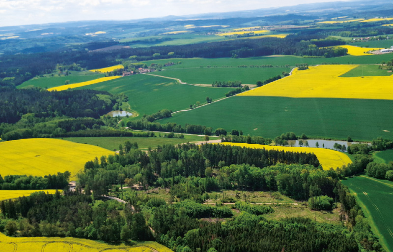
The Výrovka river basin as a suitable area for monitoring and comparing hydrological and landscape characteristics
The Výrovka river basin, as a compact area covering 542.5 km2, is very suitable for monitoring hydrological characteristics and comparing them in different landscape types. It is located on the border of the Lower Vltava and Upper and Middle Elbe sub-basins, extending in a range of 175–555 m above sea level, with a total of six landscape types according to the typology of the contemporary landscape of the Czech Republic. Simultane-ously, there is a varied mosaic in terms of geological subsoil and soil types. There have also been major changes in land use in this basin, mainly due to intensive agricultural activity and related watercourse modifications and amelioration. Monitoring activities within the project SS02030027 ”Water systems and water management in the Czech Republic in conditions of climate change” are currently taking place in the Výrovka river basin.
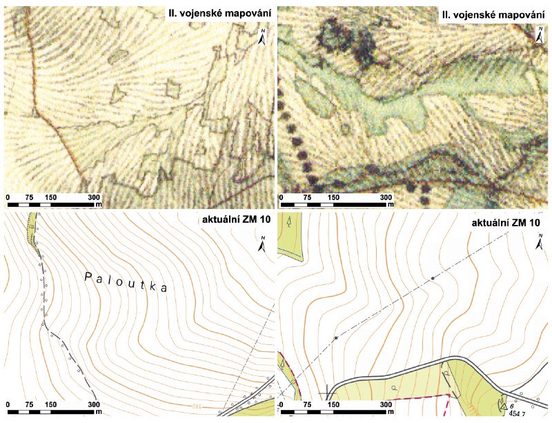
Monitoring changes in the landscape development on the northeastern edge of the Hřebeny Mountains with a focus on wetlands
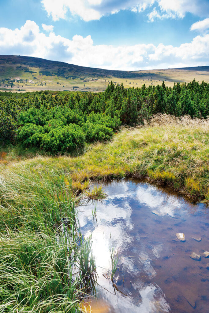
This article deals with changes in wetlands on the north-eastern edge of Hřebeny Mountains in the last 180 years. It assesses the dynamics of these landscape elements in space and time. The cadastral areas of Čisovice, Řitka, Kytín, and Nová Ves pod Pleší were selected, with a total area of 3,785.57 ha. Analysis was carried out on the basis of the Imperial obligatory prints of the maps of the stable cadastre from 1840, an orthophotomap, and field research from 2020; it distinguished wetlands in the monitored area into continuous, extinct and new. The background data were processed in ArcGIS software, version 10.7.1. The area of wetlands decreased from 289.34 ha in 1840 (7.6% of the monitored area) to 39.26 ha in 2020 (1.04% of the monitored area). Based on the study of available data, three types of wetland habitats were classified: wet meadows, wet meadows with woody plants, and ponds.

Problematics of archive map data interpretation, specifically the wetland habitats
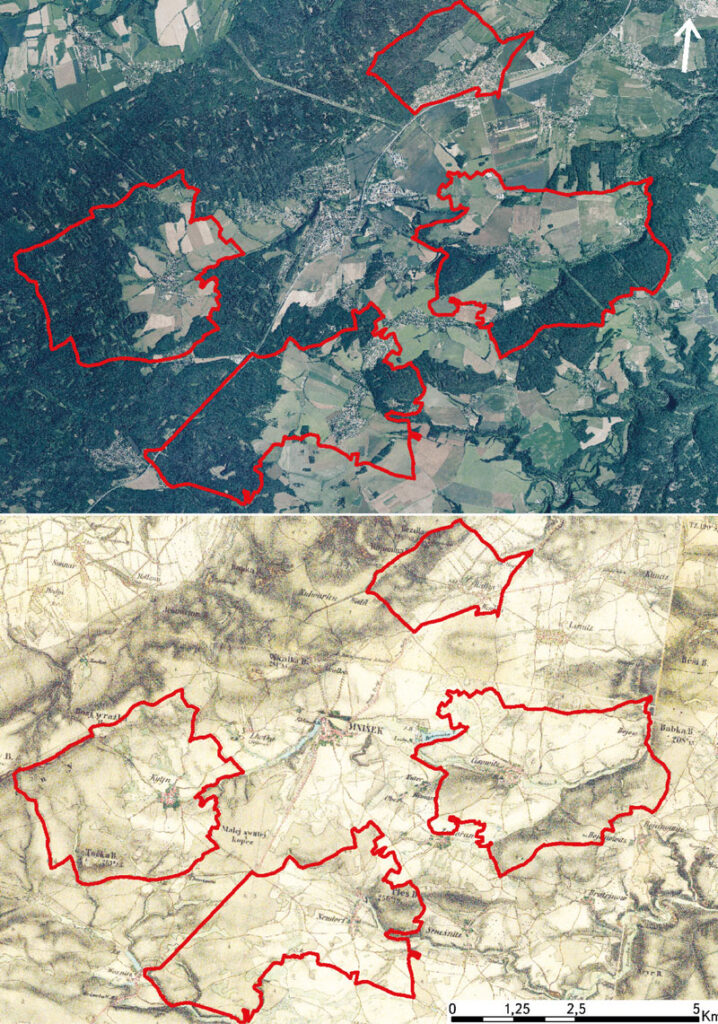
The article presents available on-line archive maps from the websites of the Archive of the Surveying Office and the Geoinformatics Laboratory of the J. E. Purkyně University, that provide an overview of the historical wetland habi- tats location. The main research question is to find out the potential use of historical maps for the identification of the historical wetlands in the Czech Republic and the evaluation of various interpretations of wetland habitats based on these sources. Examples of wetlands on historical map data in the upper part of the Výrovka River basin are presented.
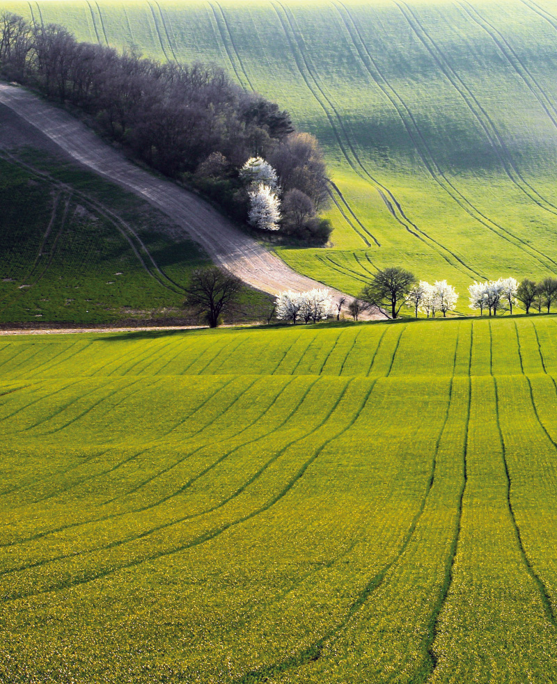
The analysis of agricultural landscape development shown on selected cadastral districts in the upper part of the Výrovka River basin
V tomto článku jsou ve vybraných katastrálních územích s převažující plochou zemědělské půdy porovnávány aktuální land use a struktura krajiny s historickým stavem z podkladů Císařských povinných otisků stabilního katastru. Jsou zde nastíněny možnosti využití analýz historického vývoje krajiny ke krajinné obnově v zemědělských oblastech, zejména s ohledem na obnovu mokřadních ekosystémů a revitalizaci vodních toků.
TGM WRI HEIS: 25 years of development and operation of the information system
V letošním roce je tomu rovných 25 let od zahájení vývoje (a následně pak provozu) Hydroekologického informačního systému VÚV TGM (HEIS VÚV). Tato doba je z hlediska kontinuálního vývoje a provozu informačního systému v současném prostředí takřka neustálých technologických a organizačních změn téměř úctyhodná a zcela jistě si zaslouží jak alespoň malé ohlédnutí za uplynulým obdobím, tak také stručnou rekapitulaci zaměřenou na současnost informačního systému (čtenář může namítnout, že zde by se nabízelo zmínit se podrobněji i o výhledu a plánech do budoucnosti, v této oblasti si však spekulovat příliš netroufáme, a proto ji zmíníme pouze stručně v závěru textu).

Surface Water Status Assessment for the Third Cycle River Basin Management Plan of the Czech Republic
The aim of this article is to acquaint the professional public with the summary results of the assessment of chemical status and ecological status/potential of surface water bodies “river” and “lake” categories in the Czech Republic for 2016–2018. This assessment is one from the basis for preparation of the Third River Basin Management Plan (2021–2027) at all its levels: sub-basin plans, national plans, and international plans of the Elbe, Danube, and Oder river basin districts.
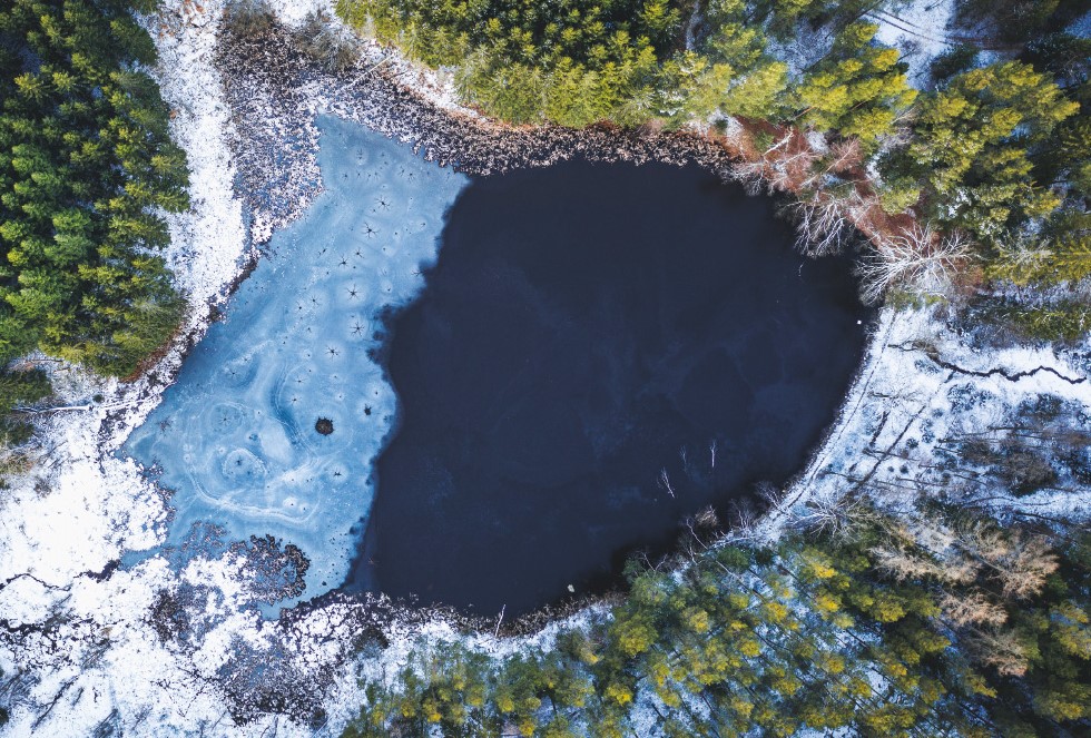
The trajectory of wetlands development in the upper part of the Výrovka river basin over the last 180 years
The article is focused on analysis of the change of wetlands coverage and the representation of various types of wetlands in the upper part of the Výrovka river basin over the last 180 years. The historical maps of the Stable Cadastre, current orthophotographs and GIS layers of actual localization and classification of different types of land cover were used as data sources.
Wetlands on historical maps
This article presents easily accessible archive maps that provide an overview of the historical location of wetlands and they are also suitable for GIS analysis.
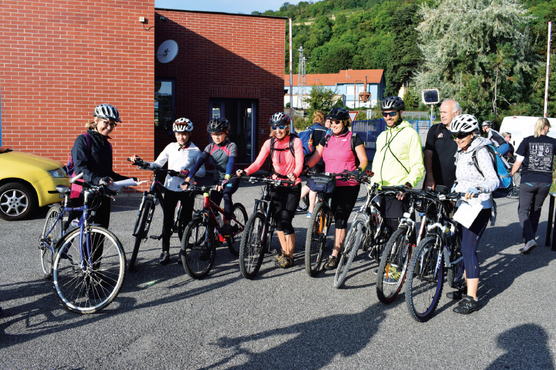
Water management fifty 2019
Výzkumný ústav vodohospodářský T. G. Masaryka, v. v. i., se u příležitosti oslav své 100leté existence ujal organizace 46. ročníku Vodohospodářské padesátky. Kromě klasického výběru mezi kolem a pohorkami se letos mohli účastníci vůbec poprvé svézt i na koloběžce.
The assessment of the status of surface water bodies in the Czech Republic for the period 2013–2015
This article aims to present to the general public the results of the assessment of the ecological status/potential and chemical status of surface water bodies categories “river“ and “lake“ for the period 2013 to 2015 in the Czech Republic. The assessment was carried out in 2017 by the Water Research Institute of T. G. Masaryk, p. r. i.