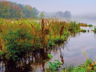
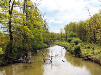
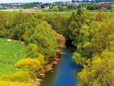
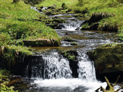
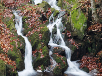
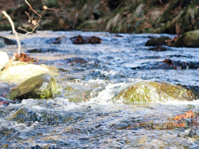
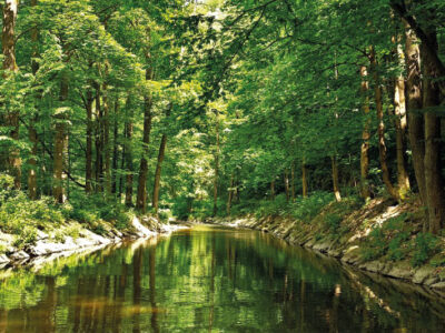
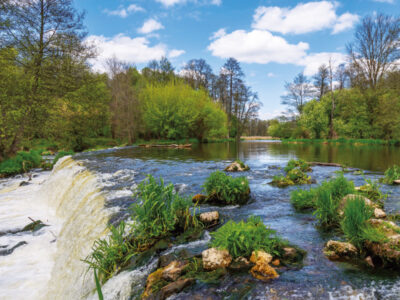
Hydraulics, hydrology and hydrogeology

Measuring annual precipitation with a radar rain gauge in severe mountain conditions

The aim of this article is to describe the experience gained while using alternative technology for measuring annual precipitation in severe mountain conditions without a source of electrical energy. For this purpose, a Lufft WS100 radar precipitation sensor was installed in Šumava in 2020 at an altitude of 1270 m above sea level. The measurements so far have shown evident advantages; for example, maintenance free sensor, detailed measurement step, and distinction of the type of precipitation. The question remains how accurate the measurement is, when during some precipitation episodes the radar precipitation sensor probably overestimates its measurements. Accurate comparison with other measurements is difficult in these mountain ridge conditions. On the other hand, the radar sensor also gives accurate measurements during some precipitation episodes, which we verify by a non-heated tipping bucket rain gauge located within the station and also by measuring the height of the snow. Using these proxy data, systematic error was excluded. Measurements will continue for a more detailed evaluation. The radar sensor is, among other things, part of the monitoring of Kaplický potok in Boubín National Nature Reserve, where runoff is also monitored. From this point of view, information about precipitation and its type is important for the evaluation of the hydrological properties of the basin.  

The current version of the BILAN model

BILAN je celistvý konceptuální model v denní/měsíční struktuře (schéma je uvedeno na obr. 1), simulující složky hydrologické bilance na povodí. Přestože jeho vývoj byl nastartován ve VÚV TGM již počátkem devadesátých let minulého století, jde o model, který je v České republice stále standardně používán a zůstává přístupný laické i odborné veřejnosti. Například je nedílnou součástí řešení aplikace/systému HAMR [1], ale byl použit i jinde [2–4]. Mezi hlavní výhody modelu oproti jiným řešením patří interní kalibrační algoritmy, možnost přímého vkládání dat o užívání vod a nízká výpočetní náročnost vhodná pro variantní simulování (např. dopadů klimatické změny na vodní režim).

Annotation of the exhibition Irrigation – rediscovered heritage, its documentation and popularization

As a response to landscape drainage in the modern era, caused by the intensification of agriculture, the drying up of ponds, and land reclamation activities, interest in the opposite process has reappeared, i.e. irrigation. Existing irrigation systems, at present often non-functional and preserved only in parts, have become the subject of interest for this project which tried to capture the historical development of this specific water management field as well as part of the industry associated with the implementation of irrigation and the production of soil irrigation equipment.

Professional events in 2015

This article is available in Czech only. For translation or more information on this topic, please contact author. Přinášíme Vám přehled odborných akcí z oboru vodního hospodářství konaných v roce 2015 a také poslední akce konané v tomto roce, na které se můžete ještě zaregistrovat. Organizační garance většiny dále uvedených odborných akcí náleží Ing. Václavu… Read more »

Results and outputs of the project entitled “Support for long-term planning in the field of water management in the Krkonoše National Park with an emphasis on solving the issue of the effect of technical snowmaking on the decrease in flows with the aim of increasing the long-term effectiveness of nature and landscape protection”

This article is available in Czech only. For translation or more information on this topic, please contact author. Projekt s názvem „Podpora dlouhodobého plánování v oblasti vodního hospodářství na území Krkonošského národního parku s důrazem na řešení problematiky vlivu technického zasněžování na pokles průtoků s cílem zvýšit dlouhodobou efektivitu ochrany přírody a krajiny“ (ID projektu: TH02030080) z programu Epsilon Technologické agentury… Read more »

Centrum Voda (Center Water)

Centrum Voda je výzkumný projekt, který hledá řešení problémů vyplývajících z klimatické změny a jejího vlivu na vodní poměry. Snažíme se nalézat odpovědi na základní otázky, jestli dokážeme zajistit dostatek kvalitní vody nejen pro potřeby člověka, ale i pro naši krajinu, zda se zvládneme vyrovnat s přívalovými povodněmi a jak dále snižovat znečištění vodního prostředí.

The analysis of agricultural landscape development shown on selected cadastral districts in the upper part of the Výrovka River basin

V tomto článku jsou ve vybraných katastrálních územích s převažující plochou zemědělské půdy porovnávány aktuální land use a struktura krajiny s historickým stavem z podkladů Císařských povinných otisků stabilního katastru. Jsou zde nastíněny možnosti využití analýz historického vývoje krajiny ke krajinné obnově v zemědělských oblastech, zejména s ohledem na obnovu mokřadních ekosystémů a revitalizaci vodních toků.

Testing of a prototype separation device designed for rainwater treatment

Článek shrnuje poznatky získané v rámci řešení výzkumného projektu „Technologie separace specifických polutantů ze srážkových vod“ (TH03030223), který se zabýval čištěním srážkových vod ze zpevněných ploch a komunikací zatížených nerozpuštěnými látkami (NL), polycyklickými aromatickými uhlovodíky i těžkými kovy. Projekt si kladl za cíl vyvinout účinnou technologii, která by uvedené polutanty ze srážkových vod separovala.

Grey water footprint of pollution discharged from wastewater treatment plants in the Czech Republic registered in the water balance in the period 2002–2018 – data set

Koncept vodní stopy byl představen v roce 2002 [1] a dnes je jedním z rozšířených nástrojů pro hodnocení udržitelnosti užívání vodních zdrojů [2]. Vodní stopa patří do rodiny environmentálních stop [3], které umožňují podívat se na problémy užívání přírodních zdrojů z jiné perspektivy. Šedá vodní stopa je kvalitativní ukazatel převádějící vypouštěné znečištění na objem vody potřebný k jeho naředění na koncentrace neškodné pro životní prostředí [4].

The influence of Prague on water quality in the Vltava and the Czech Elbe

This paper deals with the development of water quality in the Elbe in the section between its confluence with the Vltava and the Hřensko border profile in 1980–2020, and with the influence of Prague on its pollution levels. After a significant improvement in 1985–2000, the quality of water discharged through the Hřensko profile today is at least at the level of the Federal Republic of Germany. Evaluation of substance transport shows that the Vltava contributes a larger share of pollution to the Elbe simply because it has higher flows. Prague contributes to pollution of the Vltava and the Elbe by discharging phosphorus.
As for other long-term indicators, it is an insignificant source.
In 2010–2020, there is a significant level of concentrations of pharmaceuticals, which come exclusively from the discharge of municipal wastewater treatment plants (WWTP). Many pharmaceuticals regularly occur in concentrations of tens to hundreds of [ng/l], and resistant pharma-ceuticals (gabapentin, metformin, oxipurinol, carbamazepine) are transported to Prague from the Vltava basin through the Orlík and Slapy reservoirs with a high theoretical retention time. The transport of resistant pharmaceuticals through relevant profiles corresponds mainly to the number of inhabitants in their river basins because they obviously pass through WWTP and do not degrade further in the river either.

A retrospective view of the Šumperk water supply system from the 1960s to the present

In the second half of the 20th century, the long-term problem of supplying the town of Šumperk with drinking water was finally solved. New sources of drinking water supplemented the missing capacities in the form of surface abstraction from Divoká Desná within the newly built collec-tive water supply system, together with the use of sources in Rapotín and Olšany. A significant contribution to solving the problem was the recon-struction of the water supply network, water reservoir, and intake facilities, which reduced losses. An important factor that has reduced the water consumption of the population is, of course, the significant increase in water and sewerage prices in the last 20 years, which had an impact on Šumperk as well. The operational and organizational conditions of the town’s drinking water supply were negatively affected by society-wide de-velopment, which ultimately meant an increase in operating losses in the water supply network due to limited funds for the renewal and upgrading of the water supply network. The political changes in 1989 and the following period were reflected not only in the organizational conditions of the town’s drinking water supply, but also in the final consumption and price of drinking water, both in the Šumperk region and across the whole of the Czech Republic. With the example of Šumperk, it is also possible to illustrate the transformation of the water industry after 1989 and possible diffi-culties, new starting points, and challenges for its future development.

Impact of climate change on runoff and development of forest composition in the coming decades in a selected river basin in Slovakia

In this study, the authors dealt with the impact of climate change on the hydrological regime and runoff in a selected river basin in Slovakia. The research also aimed to estimate changes in forest communities during climate change to runoff processes in the river basin. Two scenarios of change of land use with forest communities and two global climate change scenarios were used. Land use change scenarios were created for the entire territory of the Slovak Republic at the Technical University in Zvolen. Outputs from the Koninklijk Nederlands Meteorologisch Instituut (KNMI) and Max-Planck-Institut (MPI) regional climate change models – both with the A1B emission scenario – were also used for this research. Assum-ing these scenarios, the characteristics of the hydrological regime were simulated by the distributed WetSpa rainfall-runoff model. Based on the research results, it can be estimated that the air temperature will increase, especially in winter, which could result in less snow accumulation and increased runoff in the basin.
The Hron river basin will manifest itself in an increase in mean monthly flows, especially during the autumn and winter months. This may be due to higher temperatures and earlier snowmelt in the area. However, we see that due to climate change, runoff will react in the opposite way in the sum-mer. Compared to the current situation, we assume that there will be an increase in the extremes of the runoff regime in the winter and a decrease in the summer and autumn. Climate models suggest a change in the distribution of atmospheric precipitation, which may result in an increase in floods, droughts, and other extreme weather events.

The Výrovka river basin as a suitable area for monitoring and comparing hydrological and landscape characteristics

The Výrovka river basin, as a compact area covering 542.5 km2, is very suitable for monitoring hydrological characteristics and comparing them in different landscape types. It is located on the border of the Lower Vltava and Upper and Middle Elbe sub-basins, extending in a range of 175–555 m above sea level, with a total of six landscape types according to the typology of the contemporary landscape of the Czech Republic. Simultane-ously, there is a varied mosaic in terms of geological subsoil and soil types. There have also been major changes in land use in this basin, mainly due to intensive agricultural activity and related watercourse modifications and amelioration. Monitoring activities within the project SS02030027 ”Water systems and water management in the Czech Republic in conditions of climate change” are currently taking place in the Výrovka river basin.

Detection of gully erosion using Global Navigation Satellite Systems in Myjava – Turá Lúka

SUMMARY This paper shows the partial outcomes of a study focused on monitoring gully erosion in the Myjava river basin. The study showed the progress of dynamic changes in gully erosion in the location of Turá Lúka using various surveying techniques from 2014 until present. The study shows that selection of the surveying technique depends on… Read more »

Changes in precipitation and runoff in river basins in the Czech Republic during the period of intense warming

The basic meteorological variables that affect the hydrological regime are atmospheric precipitation and air temperature. Both fluctuate not only in the short term and in the annual cycle, but also in the long term. Long-term changes in both of these variables have the character of periodic fluctuations around the mean values. Since about 1980, there has been a systematic increase in air temperature in the Czech Republic. This article provides information on how the climate fluctuations that this change brings affect the precipitation and runoff regime in our territory.

Occurrence of pesticides in the Punkva river

The Moravian Karst is the largest and most karstic area in the Czech Republic, and, as such, it is a protected landscape area (PLA). The karst area occupies a strip of Devonian limestone north of Brno. The north part of Moravian Karst is drained by the river Punkva and its headwaters. One of the biggest cave systems in central Europe is located there, Amaterska cave, which is more than 40 km long.

Despite the strict protection measures that are in place in the PLA, the presence of pollutants and potentially hazardous substances has recently been detected in the Punkva river and its catchment. The sources of this pollution are found both within the territory of Moravian Karst PLA and in the river´s catchment, and they are related to anthropogenic activities and land use. This article focuses on the occurrence of pesticides, especially triazine and azole pesticides and their polar metabolites. In 2020, a new significant contaminant, 1,2,4-triazole, a common relevant metabolite of azole pesticides, was found at the site concerned. These substances can have fatal effects not only on the endemic organisms living in the Moravian Karst, but they can also endanger human health because the local groundwater is used as a source of drinking water. Thanks to the studies carried out, the protection zones around the cave system have been extended, reducing the negative effects of agricultural activities in the area of interest.

Monitoring changes in the landscape development on the northeastern edge of the Hřebeny Mountains with a focus on wetlands

This article deals with changes in wetlands on the north-eastern edge of Hřebeny Mountains in the last 180 years. It assesses the dynamics of these landscape elements in space and time. The cadastral areas of Čisovice, Řitka, Kytín, and Nová Ves pod Pleší were selected, with a total area of 3,785.57 ha. Analysis was carried out on the basis of the Imperial obligatory prints of the maps of the stable cadastre from 1840, an orthophotomap, and field research from 2020; it distinguished wetlands in the monitored area into continuous, extinct and new. The background data were processed in ArcGIS software, version 10.7.1. The area of wetlands decreased from 289.34 ha in 1840 (7.6% of the monitored area) to 39.26 ha in 2020 (1.04% of the monitored area). Based on the study of available data, three types of wetland habitats were classified: wet meadows, wet meadows with woody plants, and ponds.

Comparison of hydrological characteristics of M-day discharges of the reference period 1981–2010 and the considered reference period 1991–2020

According to the Czech technical standard ČSN 75 1400 Hydrological data of surface waters, M-day discharges are a part of the Basic hydrological data [1]. The values of M-day discharges in water gauging stations are derived from time series of observed mean daily discharges over a defined reference period. The reference period 1981–2010 is currently used for design purposes [2]. With the end of the second decade of the 21st century, a change in the reference period for 1991–2020 is being considered. In the past, the Czech Hydrometeorological Institute (CHMI) provided hydrological data for the reference periods 1931–1940, 1931–1960, and 1931–1980.

Balance evaluation of selected water quality indicators on the tributaries of Vranov reservoir

Most of the reservoirs in the Czech Republic have been built as multifunctional reservoirs, with the basic functions being storage and protection. The way the catchment area upstream of a reservoir is used has a significant impact on water quality. Pollution sources can be divided into point, area, and diffuse sources. Being continuous or recurrent, point pollution is not significantly influenced by meteorological factors and it is linked to narrowly delimited areas such as settlements, wastewater treatment plants (WWTPs), industrial plants, agricultural facilities, etc. Area pollution is difficult to observe as it is irregular and depends on meteorological, soil, morphological, and vegetation characteristics [4]. The category of diffuse sources usually includes small diffuse point sources of pollution, namely municipal, agricultural, industrial, as well as traffic pollution, leachates from landfills, etc.

Automatic watershed delineation in the Czech Republic using ArcGIS Pro

Manual watershed delineation by watershed divides has traditionally been performed by means of an analysis of topographic maps and contour lines. With the availability of digital elevation models, watershed and streams delineation is performed automatically, which reduces the time spent on manual delineation. In this study, we introduce the process of automatic delineation and the models available within the toolbox Arc Hydro Tool Pro, created by the company ESRI for the ArcGIS Pro software. Automatic delineation was implemented by means of different methods for selected watersheds in the Czech Republic, varying in area and elevation.

Zero isochion in the framework of geomorphological regions in Czechia: its extraction from the MODIS imagery and its dynamics

Since December 2012, during every winter season, the altitude of the zero isochion (snowline) has been determined at the Czech Hydrometeorological Institute for the purposes of operational hydrology. The reason is the estimation of the amount of water stored in snow cover, which is inevitable activity for Czech hydrologists who naturally want their forecasting models to give relevant results. In order to get a better idea about current spatial distribution of snow cover in Czechia, the information on the zero isochion has been extracted from the MODIS imagery coming from the Terra satellite.

Practical examples of using GIS in hydrology at the Czech Hydrometeorological Institute

GIS technologies are widely used in the Hydrology Department of the Czech Hydrometeorological Institute (CHMI). The processing of geospatial data, which are used in hydrology for analytical tasks, and the development of GIS technologies in the last two decades have contributed to the spread of GIS in the CHMI practice. The use of GIS tools is shown in four examples. The first one focuses on the creation of GIS data. The second example concerns the preparation of input source data for the derivation of the hydrological characteristics of M-day discharge, which, according to Czech Standard 75 1400 Surface water hydrological data, are among the basic hydrological data. The third example describes the use of GIS in the preparation of hydrological assessments according to the above-mentioned standard (75 1400), which usually result in M-day or N-year-flood discharges in a specified profile of a certain watercourse. The fourth example focuses on the use of GIS in operational hydrological service, specifically in the development of the Flash Flood Indicator, which determines the level of risk of flash flood formation or occurrence based on current land saturation and radar rainfall estimates.

Mini-JET device as a tool for determination of soil erodibility characteristics

The article describes a method for determining the erodibility of incohesive agricultural soils by means of the critical shear stress measuring. The “Jet Erosion Test” (JET) was used to determine the critical shear stress. The mea-
surement was performed using a modified Mini-JET device. The device is very suitable for field measurements, because it is small, light, requires a relatively small amount of water, and can be operated by single person. The principle of measuring the critical shear stress of the soil is based on monitoring the rate of erosion crater formation by the action of a water jet of known kinetic energy. Based on the erosion crater development, the erosion parameters of the soil, such as the critical shear stress and the erodibility coefficient, can be calculated.

Problematics of archive map data interpretation, specifically the wetland habitats

The article presents available on-line archive maps from the websites of the Archive of the Surveying Office and the Geoinformatics Laboratory of the J. E. Purkyně University, that provide an overview of the historical wetland habi-
tats location. The main research question is to find out the potential use of historical maps for the identification of the historical wetlands in the Czech Republic and the evaluation of various interpretations of wetland habitats based on these sources. Examples of wetlands on historical map data in the upper part of the Výrovka River basin are presented.

A retrospective view of the Šumperk water supply system up to the 1960s

The article focuses on the water industry sector. It deals with the development of drinking water supply in Šumperk town from the Middle Ages to the 1960s. According to the water supply network development, the text is structured into individual chapters, focusing on the interesting period of the late 19th century, when a municipal water plant was established. The water plant was also the first company managed by the city council at its establishment. It was an excellent good practice example for similar towns in the Czech lands, both technologically and operationally. Subsequent chapters focus on expanding the water supply network, reservoirs, and intake areas, which had to be sized for the increasing water consumption associated with the city‘s dynamic development in the late 19th and first half of the 20th century. The final chapter summarises the development of the municipal waterworks project from 1945 until the year when the town of Šumperk was connected to the water intake sources from the Kouty-Šumperk group water supply system. The paper is an inspiring retrospective look into the history of the municipal water supply. It can also be a helpful comparison with the current state, building possibilities and limits of the water supply infrastructure.

Drought in the Upper Metuje Basin in 2014–2019

In the years 2014–2019, there was a historic drought in the Czech Republic. The Department of Hydrology and Hydrogeology of the T. G. Masaryk Water Research Institute has been carrying out long-term hydrological and hydrogeological observations in the upper Metuje basin where this drought manifested itself significantly. The upper part of the catchment area of the Metuje River is located in the Police Cretaceous basin geological formation.

The alternative detemination of R-factor (Rainfall erosivity factor) in the Husí Creek catchment

Hodnocení erozní účinnosti deště je v současnosti těžištěm výzkumu v oblasti stanovení erozního ohrožení půdy. V rámci empirického modelování pomocí modelů rodiny USLE (the Universal Soil Loss Equation) je erozní účinnost deště reprezentována tzv. R faktorem, jehož hodnotu lze stanovit řadou doporučených postupů. Tento článek představuje možné alternativní způsoby určení hodnoty R faktoru na základě ročních a měsíčních sum srážkových úhrnů.

Quantification of rill erosion using contactless methods

S překotným vývojem v oblasti geoinformačních a komunikačních technologií se objevují nové možnosti mapování a kvantifikace erozních procesů způsobených přívalovými srážkami. Pro získání relevantních výsledků je důležitá kvalita, hustota a rozsah vstupních dat. Rychlý a poměrně levný sběr přesných geodat umožňují bezpilotní letecké prostředky (UAV – z anglického Unmanned Aerial Vehicle). S využitím metod digitální fotogrammetrie je možné z pořízených leteckých snímků rekonstruovat morfologii terénu odpovídající času měření.

Preservation of drinking water demand from water reservoirs in climate change conditions

This study presents interim results of an evaluation of a potential climate change impact on the preservation of drinking water demand provided by water reservoirs in the timeframe of the year 2050. Hydrological and water sources and demands balance procedures have been applied, including modelling of the storage ability of water resources and water supply systems.

Sensitivity analysis of selected input parameters of the numerical model HEC-RAS in and floodplain flow calculations

This article is available in Czech only. For translation or more information on this topic, please contact author.   Souhrn Hydraulické výpočty proudění vody v korytech vodních toků a záplavových územích se v současné inženýrské praxi provádějí primárně s použitím 1D, 2D a spřažených 1D/2D numerických modelů. Matematický model je v případě zmiňované 2D schematizace… Read more »

Prediction model of water quality around Prague

This article is available in Czech only. For translation or more information on this topic, please contact author.   Souhrn V poslední době se velmi diskutuje – a to nejen mezi odbornou veřejností – o dopadech změny klimatu na vodní režim v přírodní krajině. Řešení OP Praha – pól růstu se zaměřilo i na krajinu… Read more »

Adaptation of towns and municipalities to floods and drought

This article is available in Czech only. For translation or more information on this topic, please contact author.   Souhrn Realizace komplexních adaptačních opatření je v posledních letech významným trendem ve všech velkých městech a obcích Evropy. Potřeba přizpůsobení se změně klimatu, vyznačující se střídáním krátkých a intenzivních povodňových epizod [1] a dlouhých období sucha,… Read more »

History and future development of rainfall-runoff characteristics on the outskirts of Prague

This article is available in Czech only. For translation or more information on this topic, please contact author.   Souhrn Tento příspěvek prezentuje studii vývoje srážkoodtokových charakteristik v šesti povodích na okraji Prahy od roku 1920 s výhledem do roku 2050. Kvůli neexistujícímu dlouhodobému monitoringu bylo hodnocení provedeno prostřednictvím srážkoodtokového modelování v prostředí HEC-HMS. Klíčovým… Read more »

Groundwater formation in urban areas regarding peripheral parts of Prague

This article is available in Czech only. For translation or more information on this topic, please contact author.   Souhrn Podzemní voda je nedílnou součástí hydrosféry a hydrologického cyklu ve zdravé krajině, která je schopna lépe odolávat hydrologickým extrémům, jako jsou povodně nebo dlouhodobé sucho. Hlavním zdrojem podzemní vody jsou srážky. V urbanizovaných oblastech je… Read more »

Surface Water Status Assessment for the Third Cycle River Basin Management Plan of the Czech Republic

The aim of this article is to acquaint the professional public with the summary results of the assessment of chemical status and ecological status/potential of surface water bodies “river” and “lake” categories in the Czech Republic for 2016–2018.
This assessment is one from the basis for preparation of the Third River Basin Management Plan (2021–2027) at all its levels: sub-basin plans, national plans, and international plans of the Elbe, Danube, and Oder river basin districts.