Irrigation – rediscovered heritage, its documentation, popularisation and protection based on the example of historical meadow irrigation systems
Objekty závlah byly budovány a fungují převážně jako součást většího nebo menšího funkčního celku. Jejich význam i z pohledu potenciální pa-mátkové ochrany tak roste s identifikací a dokumentací nejen solitérních staveb, ale zejména celých soustav/funkčních celků a popisem vazeb mezi nimi. Samostatný objekt či stavba nemusejí být nijak výjimečné, avšak jejich zapojení do většího funkčního celku může vytvářet unikátně pojaté řešení. V oboru vodního hospodářství se obzvlášť projevuje důležitost a význam kritérií, jako je hodnota typologická, hodnota technologického toku, autenticita formy a funkce, hodnota technologických a systémových vazeb s přesahem do zemědělství či průmyslu. Článek přináší informace o možnostech využití tradičních metod historického a archivního výzkumu a dokumentace lokalit, jakož i o využití moderních nástrojů pro plošně rozsáhlejší systémy, včetně metod digitalizace a digitálního zpracování podkladů.
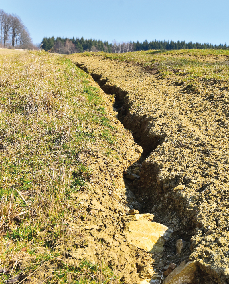
Quantification of rill erosion using contactless methods
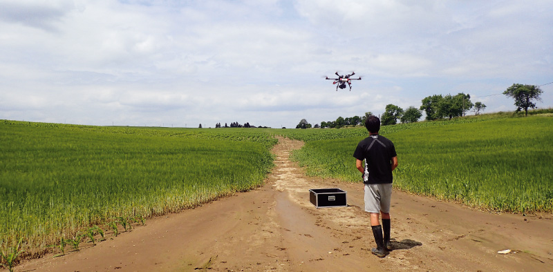
S překotným vývojem v oblasti geoinformačních a komunikačních technologií se objevují nové možnosti mapování a kvantifikace erozních procesů způsobených přívalovými srážkami. Pro získání relevantních výsledků je důležitá kvalita, hustota a rozsah vstupních dat. Rychlý a poměrně levný sběr přesných geodat umožňují bezpilotní letecké prostředky (UAV – z anglického Unmanned Aerial Vehicle). S využitím metod digitální fotogrammetrie je možné z pořízených leteckých snímků rekonstruovat morfologii terénu odpovídající času měření.
Determination of soil loss from erosion rills by method of digital photogrammetry and method of volumetric quantification
This article presents the first results of the research focused on the recording of rill erosion, and its evaluation using the outputs of the two methods that can be used to determine the soil yield. The consequences of erosion have been documented on a selected pilot site, both as a direct method of volume quantification (using an profile meter – so called soil erosion bridge) and with the use of unmanned aircraft in close-up photogrammetry (UAV).