Hydraulics, hydrology and hydrogeology

Development and current practice of groundwater balance in Czech Republic: from reserve classification to comprehensive assessment of natural resources

This article presents a comprehensive overview of the evolution of methodological approaches to groundwater balance assessment in Czechoslovakia and the Czech Republic from the 1960s to the present. It outlines the transition from a static evaluation of “exploitable re-serves” toward a dynamic, process-based concept, emphasizing regular comparisons between actual water abstraction and natural groundwa-ter resources. This shift includes the adoption of monthly assessment intervals and quantile characteristics of base flow, aligning with the requirements of both national legislation (especially Act no. 254/2001 Coll., the Water Act) and European directives on water protection.

Dynamics of humic substances in peat habitats of Prameniště Chomutovka nature reserve

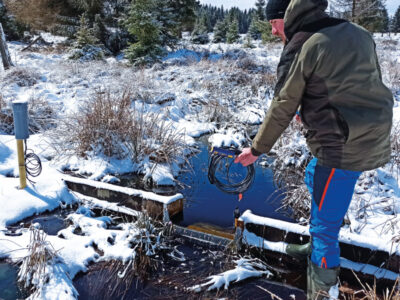
This article focuses on evaluating the concentrations of humic substances (HS) in peatland waters in the Ore Mountains region, specifically in the area near the village of Hora Svatého Šebestiána in the Prameniště Chomutovky nature reserve. The aim was to assess the impact of restoration measures on the occurrence of HS in surface and subsurface waters in a post-peat-extraction environment. Monitoring was carried out from 2022 to 2024 on two experimental sites – one restored (site A) and one predominantly non-restored (site B) – and involved extensive monthly sampling, installation of flow weirs, shallow observation wells, and meteorological stations.

The impact of hydrological extremes on ponds and small water reservoirs

This paper presents the methodological approach and key results of the research project Design of ponds and small reservoirs in terms of the possibility to comply with MPF and flood safety (TA CR, no. SS03010230). The project focused on the assessment of ponds, pond systems and small reservoirs in relation to two hydrological extremes – draught and floods. During periods of drought, the issue of maintaining the minimum residual flow is addressed. The article describes the method of determining and maintaining the minimum residual flow at these hydraulic structures. Furthermore, the article deals with the assessment of the security of these structures in terms of the safe discharge of flood flows in accordance with ČSN 75 2935 – Assessment of the safety of hydraulic structures during floods.

Typology and effects of roads on runoff regime in protected areas

The article presents the results of the project Analysis of Changes in the Water Regime of Land and Watercourses in the Krkonoše National Park Caused by the Network of Roads (TA CR, no. TITSMZP945), implemented as a public procurement commissioned by the Ministry of the Environment of the Czech Republic within the BETA2 applied research programme. The main output of the project is a two‑level typology of the road network in terms of its impact on surface and subsurface runoff. This typology was applied to the territory of Krkonoše National Park (KRNAP) in the Czech Republic and presented in the form of cartographic atlases. The article describes the principles and criteria of the proposed typology and the methodology of its application in map production, which at the basic level combines spatial analyses of road network datasets, digital terrain models and the hydrographic network, and at the detailed level incorporates the results of extensive field surveys. The original analytical procedures include, among other things, the detection of directional and elevation breaks in road segments and the delineation of micro‑catchments for individual sections. The resulting maps provide KRNAP Administration and other managers of protected areas with a tool for identifying road segments with the highest potential impact on the hydrological regime and serve as a basis for planning compensatory measures or restoration interventions.
Interview with Ing. Libor Elleder, Ph.D., hydrologist from the Czech Hydrometeorological Institute, Prague

Have you ever wondered what a hydrologist might discuss at a table with historians, archivists, and chroniclers? Can historical data help us gain a better understanding of today’s flood risk assessment? And might deeper knowledge of past floods prepare us for future ones linked to climate change? We put these questions to Ing. Libor Elleder, Ph.D., in the October hydrology issue of VTEI.

Department of Hydraulics, Hydrology and Hydrogeology: international projects starting in 2025

At the T. G. Masaryk Water Research Institute (TGM WRI), two international projects were launched in 2025. These include the SWIM project, funded under the Horizon Europe programme, and the FrauNyLu project, supported by the Interreg cross-border cooperation programme. Both projects also address hydrological topics, which will be managed by the Department of Hydraulics, Hydrology and Hydrogeology.

Magdeburg Seminar on Water Protection 2025: Water in the Elbe River Basin – yesterday, today, and tomorrow

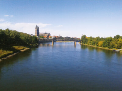
On 8–9 October 2025, the 21st Magdeburg Seminar on Water Protection will take place in Magdeburg, Germany. This regular international event, held alternately in the Czech Republic and Germany, has, over more than three decades, established itself as an important professional and scientific platform for the exchange of knowledge in the field of water management and water protection in the Elbe Basin.

Caffeine and urea as indicators of anthropogenic load on bathing ponds

Bathing ponds represent a specific ecosystem where living organisms play a dominant role in maintaining the quality of water in the water body. At the same time, they are very frequently visited, so the biggest source of pollution is from bathers. The aim of this publication is to present and evaluate possible chemical indicators of anthropogenic load – caffeine and urea at four sites (two of which during the entire bath-ing season) in the summer of 2023.

Where does a settlement end? Defining urban areas for more than just runoff analyses

The article presents a methodology for the spatial delineation of significant urban areas in the Czech Republic, primarily for the purposes of hydrological analyses and flash flood risk assessment. First, the definition of urban areas was refined in relation to existing terminology, followed by the development of a comprehensive procedure for creating layers of urban and natural features using the planimetric layers of the Fundamental Base of Geographic Data of the Czech Republic (ZABAGED®) supported by additional open data sources.
Interview with Mgr. Petr Birklen, Director General of the Povodí Odry, state enterprise

At the beginning of March this year, Petr Birklen became Director General of the state enterprise Povodí Odry. How long was the journey to this position and what does it mean to him? How did he cope with the aftermath of the 2024 floods, and how does he manage to fight against misinformation? And will the long-discussed Nové Heřminovy dam finally be built? Mgr. Petr Birklen answers our questions.
Jáchymov II.: at the right time in the right place

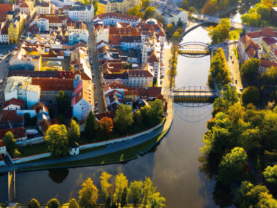
The town of Jáchymov in the Ore Mountains foothills is part of the Karlovy Vary Region and member of the West Bohemian spa family. However, Jáchymov offers a very spe-cific treatment; thanks to the high concentration of radon in the local natural mineral water, the world’s first radon spa was established here and is still operating successfully today.

Wetland evapotranspiration

A wetland is an environment where water is readily available for vegetation, and therefore intensive evapotranspiration (ET) close to the potential ET value occurs. In addition, higher ET intensities can be expected in the future due to the observed increase in temperatures associated with climate change. The impact of wetland ET needs to be considered, for example, in restoration planning or hydrological mod-elling, and it is important to draw on the current knowledge provided by the large number of papers worldwide.

The potential of grass strips for retaining surface runoff and sediment

The use of grass strips in agricultural landscapes is widely recognized for their ability to effectively reduce surface runoff and the transport of eroded particles, while simultaneously enhancing biodiversity and landscape stability. This study aimed to quantify the impact of grass strip length on sediment retention in surface runoff. Experimental measurements were conducted on enclosed plots measuring 8 × 1 metres, each with varying proportions of grass cover to simulate different grass strip widths under real-world conditions.

Interview with Ivan Tučník, Head of Group Sustainability Asahi Europe & International

How does Radegast Brewery work with water when brewing beer, what are the brewery’s aims regarding sustainability, to what extent does the brewery use the latest technological trends in its production, and why do we like bitter beer in the Czech Republic? The offer to be inter-viewed for our VTEI journal was accepted by Ing. Mgr. et Mgr. Ivan Tučník from Asahi Europe & International; in the Czech Republic, the company owns Radegast, Plzeňský Prazdroj, Velkopopovický Kozel, and many other breweries across Europe.

Historical changes in water use in Czech third-order catchments and indications of potential trends based on new regional climate models by the CHMI

The article presents the results of the Czech Hydrometeorological Institute (CHMI) obtained when addressing the sub-objectives “Scenarios of future water needs for different climate scenarios and individual sectors of water use” (DC 1.1) and “Identification of areas with deficient water resources” (DC 1.2), which are part of TA CR project No. SS02030027 “Water systems and water management in the Czech Republic in conditions of climate change (Water Centre)” and constitute specific tasks within the work package WP1 focusing on the future of water. The aim of the CHMI was to calculate and analyse how river flows upstream of gauging stations in Czechia are influenced by water use and to determine how this influence may change in relation to climate change.

Measurement and modelling of changes in the runoff regime following calamitous decay and regeneration of forest stands in small catchments in the Jeseníky Mountains

The article presents partial results of monitoring and modelling in the experimental forest catchments of Suchý, Sokolí, and Slučí streams, the right-handed tributaries of the Černá Opava in the Jeseníky PLA. These results have been generated since 2022 thanks to the NAZV project No. QK22010189 “The impact of deforestation on the water regime of small river basins” with the working title DEFOREST, which also evokes the main goal of the project; to try to capture changes in the dynamics of stands (decay, controlled and spontaneous succession, etc.) and in the runoff regime of these river basins with regard to bark beetle outbreak and the subsequent damage clearing. In all these experimental river basins, monitoring of selected hydrological regime elements (e.g. precipitation on the open area, under-canopy precipitation, volumetric soil moisture, snow gauge sensors) was established, including stationary measurement of water levels in the closing profiles of all three sub-river basins. For modelling of stand changes and hydrological response to these changes, forest stand models (including the self-developed DEFOREST application) and hydrological models HEC-HMS, SIMWE, MIKE SHE and SWAT were used. The extreme flood in September 2024 largely destroyed the water gauging stations and remodelled the watercourse beds, so in 2025 the project team will focus on restoring monitoring.

The pond system on the Bečvárka river

The article presents the pond landscape development in the Bečvárka river basin based on the interpretation of archival and current maps, including verification of the current state of pond locations. Eleven ponds with a total area of 65.28 ha were recorded on the map of the 2nd Military Mapping. Sixteen ponds with a total area of 76.64 ha were recorded on the current map. The current ponds’ total area is approximately 11 ha larger than the area of the historical ponds. This is despite the fact that almost all individual historical ponds had an area larger than at present. One of the main reasons for this is the later construction of two large ponds in the area. From a comparison of the maps, it is clear that the reduction in the areas of individual historical ponds at present is mainly caused by the overgrowth of the littoral zone.

Assessment of the hydromorphological status of river water bodies in the Czech Republic using HYMOS methodology

Assessment of the hydromorphological status and its elements (hydrological regime, continuity, morphological conditions) is part of the monitoring of the ecological status of water bodies. Hydromorphology, as a supporting component of biological assessment, has a significant impact on living organisms in aquatic ecosystems. Based on the Ministry’s request, a new methodology for assessing the hydromorphological status of water bodies category rivers (HYMOS) was developed within the TA CR project. This methodology takes into account new requirements and current knowledge in the field of hydromorphology, while also minimizing the drawbacks of previous methodologies, particularly regarding time and cost efficiency in the assessment process.

Flash flood in Brdy PLA in June 2024

The article documents the course of the flash flood at the beginning of June 2024 in Brdy PLA, in the Příbram Region, including reflection on its causes and possibilities for limiting the consequences of this type of flood in the future. Publicly available information was evaluated from the hydrometeorological situation in the Archive of weekly reports on the CHMI website for the nearest station to the flood-affected area, namely Neumětely station. In that week, the highest weekly precipitation total for the Czech Republic was recorded at Neumětely station. When evaluating landscape development based on archival maps or orthophoto maps, changes with some negative effects on water retention in the landscape were observed. It was mainly the gradual expansion of urban development into the original mosaic of dry or wet meadows and small fields, straightening and piping of watercourses, ploughing their floodplains, land reclamation of spring areas, and their subsequent replacement with arable land.

Interview with Dr. Ing. Antonín Tůma, Deputy General Director of the Morava Basin State Enterprise

For the February issue of VTEI, we interviewed a long-time employee of the Morava Basin State Enterprise, the director of the Basin administration, and since 2006 the deputy general director of this organization. A man for whom water management is not a job, but a mission. “Water is the carrier of not only life, but also information and energy. Something so simple, yet so extraordinary, irreplaceable…,” says Dr. Ing. Antonín Tůma.

The “Water Centre” project is in its second half and presents its results

The Environment for Life programme, funded by the Technology Agency of the Czech Republic, has created research centers focused on environmental issues. One of them is the “Change4Water”, which is the acronym of the “Water Management in the Czech Republic in the Context of Climate Change” project. The lead organization is T. G. Masaryk Water Research Institute, p. r. i. (TGM WRI). Other seven partner organizations are the Nature Conservation Agency of the Czech Republic (NCA CR), Czech University of Life Sciences (CZU), Czech Technical University in Prague, Faculty of Civil Engineering (FCE CTU), Czech Hydrometeorological Institute (CHMI), CzechGlobe, The Silva Tarouca Research Institute for Landscape and Ornamental Gardening, p. r. i. (VÚKOZ), and the University of Chemistry and Technology, Prague (UCT). The project duration is from July 2020 to December 2026, so currently halfway through its duration.

HYMOD-KZ database and deficit areas

This article describes the HYMOD-KZ database, available at https://shiny.vuv.cz/HYMOD-KZ/. The database provides detailed results of hydrological modelling and hydrological balance analysis of catchments (water bodies) for current and future climate conditions; it also includes updated deficit areas, the description of which is part of this article. This tool can serve as a foundation for water management ex-perts, academia, and the broader professional community as it provides outputs at the spatial resolution of water bodies. The graphical rep-resentation of results facilitates understanding of complex hydrological phenomena and supports decision-making in water management planning.

Tools for risk assessment of catchment areas for abstraction points of water intended for human consumption

In December 2020, the new EU Directive 2020/2184 on the quality of water intended for human consumption was published. This Directive places a strong emphasis on comprehensive protection of water resources and introduces an obligation to carry out risk assessment and risk management of the catchment areas for abstraction points of water intended for human consumption, compared to the previous Directive from 1998. The risk analysis of the catchment areas must be carried out for all water abstractions for drinking purposes that abstract more than 10 m3 raw water per day. In the Czech Republic, this concerns approximately 3,650 abstractions (of which about 3,500 are groundwater abstractions and about 150 surface water abstractions). On a nationwide scale, it is therefore a considerable amount of risk analyses of parts of the catchment areas, which, according to the Directive, must be performed by 2027. The main aim of the project “Tools for risk assess-ment of catchment areas for abstraction points of water intended for human consumption” (supported by the Technology Agency of the Czech Republic) is to develop a methodology for the preparation of this risk analysis of the catchment areas. In order to ensure that the risk analyses of the catchment areas to be prepared by different entities have a uniform form and structure, a form (mock-up) of what the risk analyses of the catchment areas should look like and what they should contain has been developed within the framework of the methodology. As this is a very complex issue, only the main skeleton of the methodology will be presented in this article, focusing on the basic characteristics of the abstraction and the definition of the area (the catchment areas) in which the risk activities for the quality of the abstracted raw water are determined.

Future water demand scenarios to 2050: sectoral analyses and forecasts

This article presents the results of the sub-objective “Scenarios of future water demands for different climate scenarios and individual sec-tors of water use” (DC 1.1). Which is part of TA CR project No. SS02030027 “Water systems and water management in the Czech Republic and climate change conditions (Water Centre)” and is a sub-part of the WP 1 “Prediction of the development of water resources security in the Czech Republic until 2050 in regions depending on climate change”.

Groundwater abstraction noticeably reduces the flow of some watercourses during the dry season

The paper highlights the fact that some significant watercourses dry up during periods of minimal flows due to groundwater abstraction. It provides a summary of the most affected significant watercourses in the Czech Republic. Large concentrated groundwater abstraction has a considerable impact on small and medium-sized watercourses. To select the most significant effects of abstraction on stream flows, we used the ratio of abstraction to 355-day flows from 1931–1960. Watercourses exceeding 30 % were selected. In half of the selected cases the following relationship was confirmed: the 355-day flow from 1931–1960, reduced by the abstraction rate, is approximately equal to the 355-day flow from 1991–2020. The cases where this relationship does not apply can be explained by changes in abstraction volumes, declining groundwater levels and flows in the wider area due to groundwater collection and the use of static groundwater reserves. The effect of climate change is unlikely to be present in the baseflow in the cases studied. Our analysis identified 13 cases where groundwater abstraction is severely affecting the flow of significant watercourses. In about half of these cases, there is an alternative source of water that should be used when the flow of the watercourse is at a minimum. Another option to protect water resources is to apply the minimum groundwater level or minimum residual flow under the Water Act.

Influence of retention curve parameter α on capillary barrier efficiency

This study is focused on the calculation of parameter α of the wetting branch of the retention curve and on the influence of its value on the efficiency of capillary barriers. The capillary barrier is a simple method of insulating landfills. The effectiveness of the capillary barriers was tested using numerical models, which allow greater testing variability compared to physical measurement. Thanks to numerical models, it was possible to evaluate the direct effect of changing the parameters of retention curves on the functioning of capillary barriers. Hysteresis of retention curves was included in the construction of the numerical models, and then its effect on the agreement of the model results with the measured data was evaluated. Numerical modelling is a suitable and reliable tool for verifying the efficiency of capillary barriers. Due to the sensitivity of the results to the parameters of the task, it is necessary to determine as precisely as possible all the necessary input parameters so that the resulting model has real informative value.

Old groundwater in hydrogeological regions 4410 and 4522

The article presents a project from the Technology Agency of the Czech Republic dealing with the hydrogeology of old waters in hydrogeological regions 4410 and 4522. The aim of the paper is to present a brief hydrogeological characterization of the area of interest, to present the results after the first year of the project, and to describe the uncertainties of existing information. Old groundwaters that have negligible concentrations of tritium can be considered a strategic resource because they are less susceptible to current contamination.

Methodology for creating a Map of the Vulnerability of the Quantity of Natural Groundwater Resources to Drought for the Czech Republic

Groundwater drought affecting groundwater availability is still mostly understood as a subset of hydrological drought. The impact of hydrological drought on groundwater is manifested with a delay and depends on its duration. An expert interactive Map of the Vulnerability of the Quantity of Dynamic Groundwater Resources to Drought for the Czech Republic was created as part of the TA CR project SS01010208 – “Controlled Groundwater Recharge as a Tool to Reduce the Impacts of Drought in the Czech Republic”. The presented vulnerability map is created on the basis of the use of precipitation normal and regression relationships between precipitation and total runoff and groundwater discharge (base flow) using the Base Flow Index (BFI) and ratio of base flow in the driest year of 2010–2019 to the long-term average of base flow (M index), which guarantees uniform processing for the entire Czech Republic at a scale of 1 : 50,000 and an objective comparison of the vulnerability of dynamic groundwater resources to drought throughout the country. It is also based on recorded groundwater abstraction and in the case of municipalities with individual supply, the abstraction is calculated from the number of inhabitants and the national average consumption of drinking water per capita. The Map is compiled based on the balance of dynamic groundwater resources and groundwater abstraction. It contains six categories and shows which regions and areas will struggle to have sufficient groundwater resources during periods of prolonged drought. It synthesizes all available flow logs and other data until 2020 and is designed so that the layers with variable information can be updated in the future.

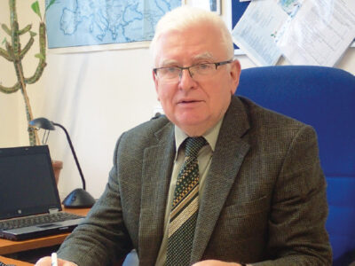
Interview with doc. RNDr. Zbyněk Hrkal, CSc., hydrogeologist, writer, and populariser of water management

The October issue of the VTEI journal deals mainly with groundwater and its management. We therefore discussed the promotion of this topic with a colleague who is engaged in research in groundwater, has been lecturing on hydrogeology
for a long time at the Faculty of Science, Charles University in Prague, and deals with the topic of water management in his publications. “The main problem in the world is not a physical lack of water, but poverty, illiteracy, and economic backwardness,” says Zbyněk Hrkal.

Danube Regional Water Lighthouse

Accessible and high-quality water is a natural resource essential for life, well-being, and social prosperity. After decades of intensive exploitation, pollution and socio-economic pressure, Europe’s freshwaters and seas are at risk of degradation. This has to be seen not only as a potential dramatic loss from an economic point of view, but also it means unpredictable ecological, social, and cultural damage. The European Commission has responded to this challenge by creating the research and innovation mission Restore our oceans and waters; with a 2030 target, the aim is to provide a systemic approach for the restoration, protection and conservation of oceans and freshwater. In 2022–2025, a development and pilot phase has been underway, during which four so-called Mission Lighthouses were launched. “The Danube Regional Water Lighthouse Action” (DALIA) aims to significantly contribute to the improvement of the state of the Danube basin; it is financed by the European Union under the Horizon Europe programme with a total subsidy of € 8,499,236. The basin is home to almost 80 million people and extends over 19 European countries, which is exceptional even on a global scale.

Hydrogeological aspects of boreholes for heat pumps

In recent years, there have been significant legislative and methodological changes in the construction and use of geothermal heat pumps (GHP), also known as ground-source heat pumps (GSHPs). The use of GHP has become a widespread
solution for heating buildings of all kinds, from family homes to industrial buildings. This article concerns GHP (ground-to-water and water-to-water types) that use shallow geothermal energy, obtained mainly through boreholes.

Development in and status of surface waters in an important drinking water source area

The paper discusses changes in of the basic parameters of surface water within the important drinking water source area of hydrogeological unit 232 Ústecká syncline, in the Svitava river basin. Emphasis is placed on the changes in the amount of water in the Svitava river and the changes in the basic physical and chemical parameters of these waters. The possible effect on local groundwater, which is intensively used for drinking purposes, is discussed. The contribution compares historical data sets with the results of current monitoring within the project SS06010044 (PPŽ VI, TA CR). The current qualitative state of surface water points to caution in promoting direct infiltration into groundwater due to the risk of contamination.

Interpolation of selected discharge rates in ungauged fourth-order catchments in the Otava basin

Knowledge of catchment runoff values is the key to a wide range of engineering and scientific applications. However, direct measurements in the scope of all fourth-order catchments in the Czech Republic are not realistic. Standard methods for estimating these parameters are local regression models, rainfall-runoff models, or other interpolation techniques. Regression models provide reliable results, but the derivation of local regression equations is demanding on the amount of input and reference data. Rainfall-runoff models have their application in design activities at a local scale. Their application in the Czech Republic is not trivial and requires knowledge of precipitation distribution. Interpolation techniques provide a fast but often less reliable approach. Most of these interpolations are not primarily intended for hydrological applications; the exception is the Top-Kriging method.