
Ladislav Kašpárek left us forever
It is with great sorrow that we announce that our colleague and friend Ladislav Kašpárek has passed away.
It is with great sorrow that we announce that our colleague and friend Ladislav Kašpárek has passed away.
The Environment for Life programme, funded by the Technology Agency of the Czech Republic, has created research centers focused on environmental issues. One of them is the “Change4Water”, which is the acronym of the “Water Management in the Czech Republic in the Context of Climate Change” project. The lead organization is T. G. Masaryk Water Research Institute, p. r. i. (TGM WRI). Other seven partner organizations are the Nature Conservation Agency of the Czech Republic (NCA CR), Czech University of Life Sciences (CZU), Czech Technical University in Prague, Faculty of Civil Engineering (FCE CTU), Czech Hydrometeorological Institute (CHMI), CzechGlobe, The Silva Tarouca Research Institute for Landscape and Ornamental Gardening, p. r. i. (VÚKOZ), and the University of Chemistry and Technology, Prague (UCT). The project duration is from July 2020 to December 2026, so currently halfway through its duration.
Accessible and high-quality water is a natural resource essential for life, well-being, and social prosperity. After decades of intensive exploitation, pollution and socio-economic pressure, Europe’s freshwaters and seas are at risk of degradation. This has to be seen not only as a potential dramatic loss from an economic point of view, but also it means unpredictable ecological, social, and cultural damage. The European Commission has responded to this challenge by creating the research and innovation mission Restore our oceans and waters; with a 2030 target, the aim is to provide a systemic approach for the restoration, protection and conservation of oceans and freshwater. In 2022–2025, a development and pilot phase has been underway, during which four so-called Mission Lighthouses were launched. “The Danube Regional Water Lighthouse Action” (DALIA) aims to significantly contribute to the improvement of the state of the Danube basin; it is financed by the European Union under the Horizon Europe programme with a total subsidy of € 8,499,236. The basin is home to almost 80 million people and extends over 19 European countries, which is exceptional even on a global scale.
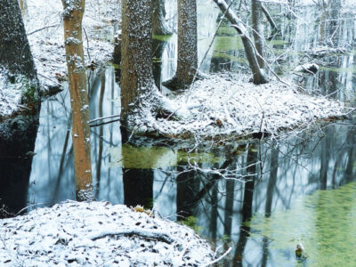
On 25th January 2024, a seminar Meeting of researchers in the Jizera Mountains was held in the conference centre of T. G. Masaryk Water Research Institute (TGM WRI) in Prague. It presented (mainly long-term) research projects implemented in the Jizera Mountains and focused on atmospheric precipitation, forest soils and forests, waters and their biota in recent decades, i.e. from peak acidification to current phenomena associated with climate change. However, no less important was the personal meeting of people who research, permanently work or live in the Jizera Mountains and are interested in the development of the situation in this area, as well as the final debate open to all.
The research project of the Technology Agency of the Czech Republic SS02030027 „Water systems and water management in the Czech Republic in conditions of climate change“, whose guarantor is the Ministry of the Environment, tries to answer the question of whether we will continue to have enough quality water. Climate change and the associated drought, as well as human behaviour and demands threaten water, and solutions must be sought for the immediate future.
BILAN je celistvý konceptuální model v denní/měsíční struktuře (schéma je uvedeno na obr. 1), simulující složky hydrologické bilance na povodí. Přestože jeho vývoj byl nastartován ve VÚV TGM již počátkem devadesátých let minulého století, jde o model, který je v České republice stále standardně používán a zůstává přístupný laické i odborné veřejnosti. Například je nedílnou součástí řešení aplikace/systému HAMR [1], ale byl použit i jinde [2–4]. Mezi hlavní výhody modelu oproti jiným řešením patří interní kalibrační algoritmy, možnost přímého vkládání dat o užívání vod a nízká výpočetní náročnost vhodná pro variantní simulování (např. dopadů klimatické změny na vodní režim).
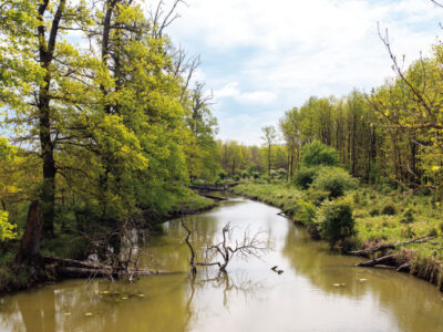
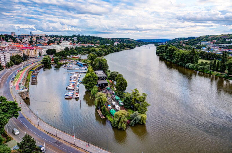
The Výrovka river basin, as a compact area covering 542.5 km2, is very suitable for monitoring hydrological characteristics and comparing them in different landscape types. It is located on the border of the Lower Vltava and Upper and Middle Elbe sub-basins, extending in a range of 175–555 m above sea level, with a total of six landscape types according to the typology of the contemporary landscape of the Czech Republic. Simultane-ously, there is a varied mosaic in terms of geological subsoil and soil types. There have also been major changes in land use in this basin, mainly due to intensive agricultural activity and related watercourse modifications and amelioration. Monitoring activities within the project SS02030027 ”Water systems and water management in the Czech Republic in conditions of climate change” are currently taking place in the Výrovka river basin.
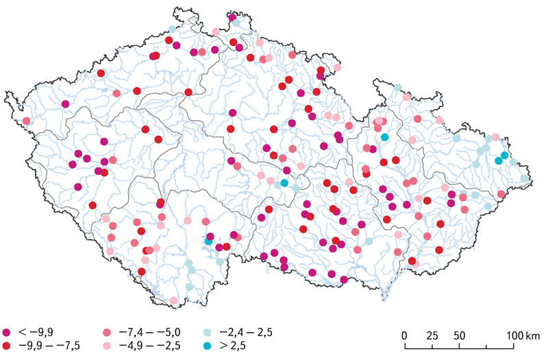
According to the Czech technical standard ČSN 75 1400 Hydrological data of surface waters, M-day discharges are a part of the Basic hydrological data [1]. The values of M-day discharges in water gauging stations are derived from time series of observed mean daily discharges over a defined reference period. The reference period 1981–2010 is currently used for design purposes [2]. With the end of the second decade of the 21st century, a change in the reference period for 1991–2020 is being considered. In the past, the Czech Hydrometeorological Institute (CHMI) provided hydrological data for the reference periods 1931–1940, 1931–1960, and 1931–1980.
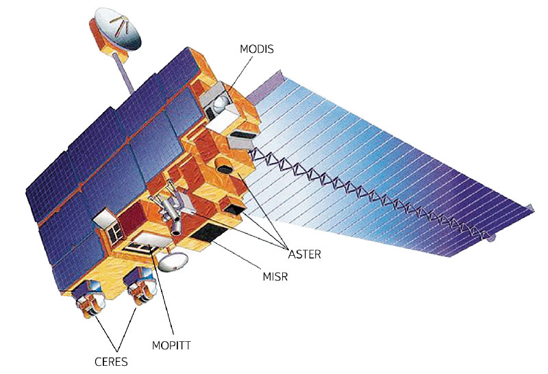
Since December 2012, during every winter season, the altitude of the zero isochion (snowline) has been determined at the Czech Hydrometeorological Institute for the purposes of operational hydrology. The reason is the estimation of the amount of water stored in snow cover, which is inevitable activity for Czech hydrologists who naturally want their forecasting models to give relevant results. In order to get a better idea about current spatial distribution of snow cover in Czechia, the information on the zero isochion has been extracted from the MODIS imagery coming from the Terra satellite.
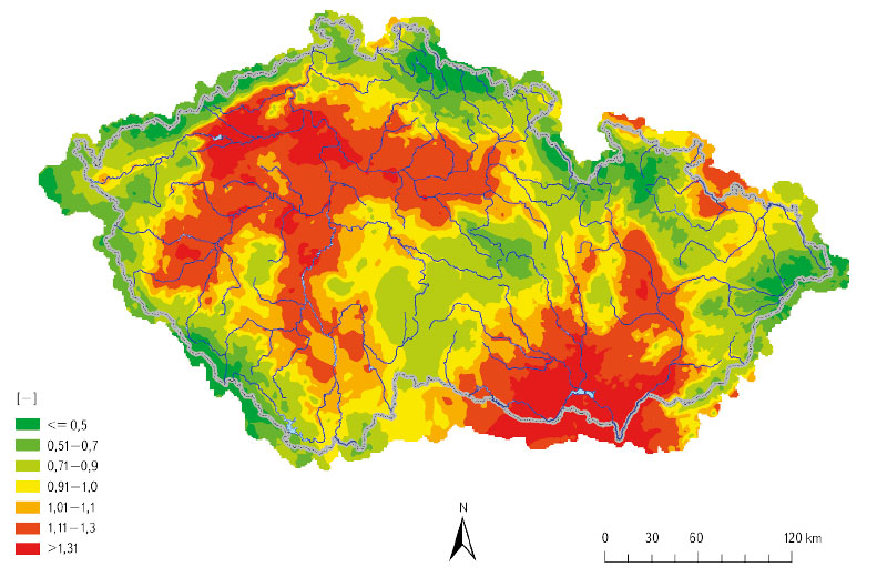
GIS technologies are widely used in the Hydrology Department of the Czech Hydrometeorological Institute (CHMI). The processing of geospatial data, which are used in hydrology for analytical tasks, and the development of GIS technologies in the last two decades have contributed to the spread of GIS in the CHMI practice. The use of GIS tools is shown in four examples. The first one focuses on the creation of GIS data. The second example concerns the preparation of input source data for the derivation of the hydrological characteristics of M-day discharge, which, according to Czech Standard 75 1400 Surface water hydrological data, are among the basic hydrological data. The third example describes the use of GIS in the preparation of hydrological assessments according to the above-mentioned standard (75 1400), which usually result in M-day or N-year-flood discharges in a specified profile of a certain watercourse. The fourth example focuses on the use of GIS in operational hydrological service, specifically in the development of the Flash Flood Indicator, which determines the level of risk of flash flood formation or occurrence based on current land saturation and radar rainfall estimates.
This article is available in Czech only. For translation or more information on this topic, please contact author. Souhrn V poslední době se velmi diskutuje – a to nejen mezi odbornou veřejností – o dopadech změny klimatu na vodní režim v přírodní krajině. Řešení OP Praha – pól růstu se zaměřilo i na krajinu… Read more »