List of articles from – 2/2022

Development of citations of the magazine VTEI

This article is available in Czech only. For translation or more information on this topic, please contact author. Časopis Vodohospodářské technicko-ekonomické informace (VTEI) vychází již 63 let. Zároveň je to pět let od ukončení spolupráce s časopisem Vodní hospodářství a začátku vydávání časopisu VTEI v současné modernizované podobě. V úvodním slovu k číslu 4–5/2015, jež… Read more »

Use of SARS-CoV-2 virus monitoring in wastewater from WWTP of various categories for epidemic surveillance in the Czech Republic

The principle of wastewater diagnostics is a suitable complementary approach that can help to gain epidemiological information on a large part of the population in a non-invasive way. The course of the pandemic spread of the new coronavirus (SARS-CoV-2) has been showing a cyclical course of successive waves of Covid-19 since 2020. For this model, a systematic detection of the occurrence of its agent in wastewater is a very effective approach.

Detection of gully erosion using the method of Global Navigation Satellite Systems in the Myjava – Turá Lúka

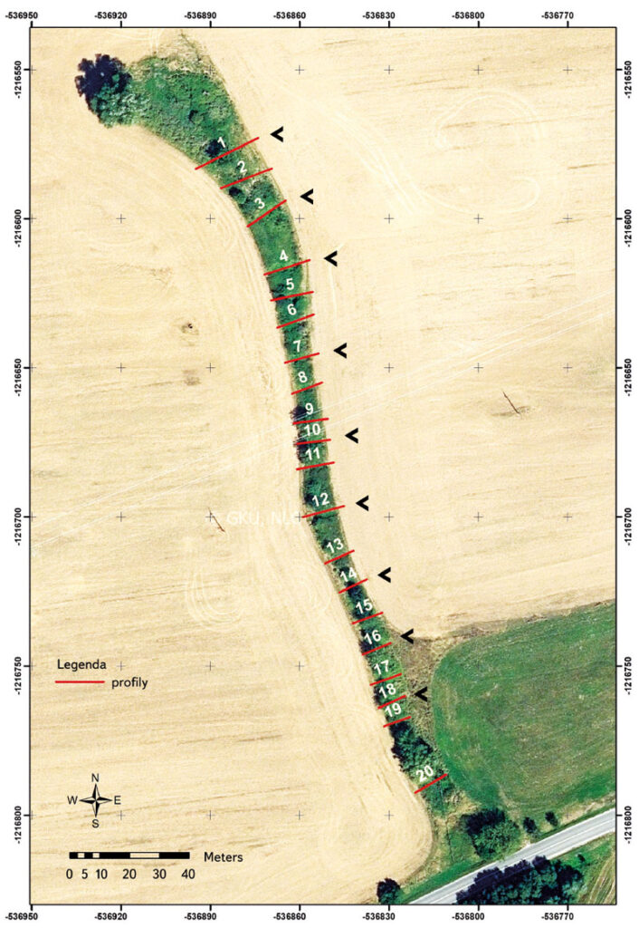
This paper shows the partial outcomes of a study focused on monitoring gully erosion in the Myjava river basin. The study showed the progress of dynamic changes in gully erosion in the location of Turá Lúka using various surveying techniques from 2014 until present. The study shows that selection of the surveying technique depends on various criteria and the aims of the task, where each possesses advantages and disadvantages. In the case of determination of the parameters of gully erosion (volume, length, and position), one of the suitable surveying techniques is Terrestrial Laser Scanning (TLS) as well as Unmanned Aerial Vehicles (UAV), which results in a point cloud. Measurement using Global Navigation Satellite Systems (GNSS) with a GPS device is sufficient for assessing gully erosion in transverse profiles, more complex sections, or in places with built anti-erosion and stabilization dams in a gully. This assumption was confirmed based on results from field measurements of an erosion gully by GNSS technology in 2017–2021. Evaluation of the results is given in this article. The given method of mapping the erosion gully was chosen for the need for detailed profile evaluation of previously identified critical sections (transverse profiles) of the monitored erosion form based on field surveying and area scanning and for simple data processing. The simplicity of this method due to the type of task, staffing, time, and volume of data predetermines and confirms the suitability of its selection for use under the given circumstances. When choosing this measuring technique, the requirements are easy access to the measuring point and a good satellite signal for GPS devices influencing the accuracy of the measurement concerning the surrounding vegetation. Sufficient testing and comparison of available surveying techniques make it possible to efficiently and realistically select suitable effective technology for monitoring erosive forms in the landscape for a predefined purpose. Contributions of this type will help researchers of similar tasks in decision-making when choosing the most suitable landscape surveying technology.

Changes in precipitation and runoff in river basins in the Czech Republic during the period of intense warming

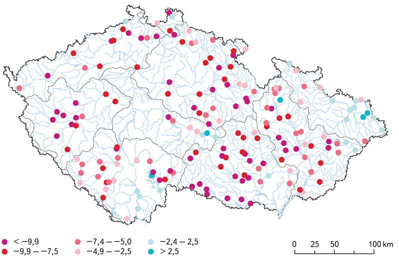
The basic meteorological variables that affect the hydrological regime are atmospheric precipitation and air temperature. Both fluctuate not only in the short term and in the annual cycle, but also in the long term. Long-term changes in both of these variables have the character of periodic fluctuations around the mean values. Since about 1980, there has been a systematic increase in air temperature in the Czech Republic. This article provides information on how the climate fluctuations that this change brings affect the precipitation and runoff regime in our territory.

Occurrence of pesticides in the Punkva river

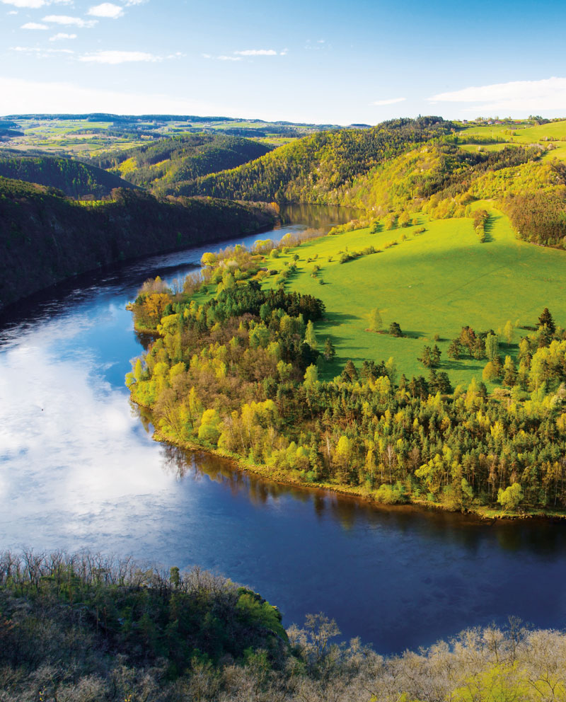
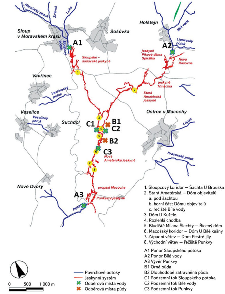
The Moravian Karst is the largest and most karstic area in the Czech Republic, and, as such, it is a protected landscape area (PLA). The karst area occupies a strip of Devonian limestone north of Brno. The north part of Moravian Karst is drained by the river Punkva and its headwaters. One of the biggest cave systems in central Europe is located there, Amaterska cave, which is more than 40 km long.
Despite the strict protection measures that are in place in the PLA, the presence of pollutants and potentially hazardous substances has recently been detected in the Punkva river and its catchment. The sources of this pollution are found both within the territory of Moravian Karst PLA and in the river´s catchment, and they are related to anthropogenic activities and land use. This article focuses on the occurrence of pesticides, especially triazine and azole pesticides and their polar metabolites. In 2020, a new significant contaminant, 1,2,4-triazole, a common relevant metabolite of azole pesticides, was found at the site concerned. These substances can have fatal effects not only on the endemic organisms living in the Moravian Karst, but they can also endanger human health because the local groundwater is used as a source of drinking water. Thanks to the studies carried out, the protection zones around the cave system have been extended, reducing the negative effects of agricultural activities in the area of interest.

Monitoring changes in the landscape development on the northeastern edge of the Hřebeny Mountains with a focus on wetlands

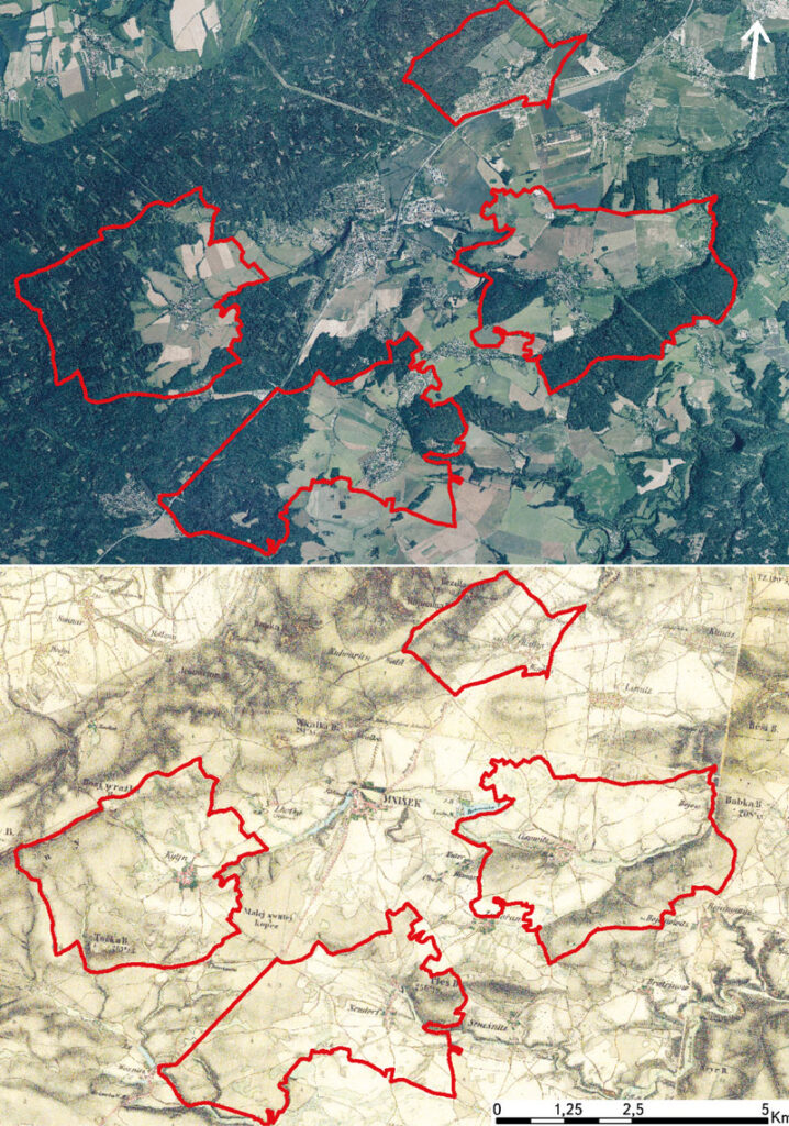
This article deals with changes in wetlands on the north-eastern edge of Hřebeny Mountains in the last 180 years. It assesses the dynamics of these landscape elements in space and time. The cadastral areas of Čisovice, Řitka, Kytín, and Nová Ves pod Pleší were selected, with a total area of 3,785.57 ha. Analysis was carried out on the basis of the Imperial obligatory prints of the maps of the stable cadastre from 1840, an orthophotomap, and field research from 2020; it distinguished wetlands in the monitored area into continuous, extinct and new. The background data were processed in ArcGIS software, version 10.7.1. The area of wetlands decreased from 289.34 ha in 1840 (7.6% of the monitored area) to 39.26 ha in 2020 (1.04% of the monitored area). Based on the study of available data, three types of wetland habitats were classified: wet meadows, wet meadows with woody plants, and ponds.

Comparison of hydrological characteristics of M-day discharges of the reference period 1981–2010 and the considered reference period 1991–2020

According to the Czech technical standard ČSN 75 1400 Hydrological data of surface waters, M-day discharges are a part of the Basic hydrological data [1]. The values of M-day discharges in water gauging stations are derived from time series of observed mean daily discharges over a defined reference period. The reference period 1981–2010 is currently used for design purposes [2]. With the end of the second decade of the 21st century, a change in the reference period for 1991–2020 is being considered. In the past, the Czech Hydrometeorological Institute (CHMI) provided hydrological data for the reference periods 1931–1940, 1931–1960, and 1931–1980.

Balance evaluation of selected water quality indicators on the tributaries of Vranov reservoir

Most of the reservoirs in the Czech Republic have been built as multifunctional reservoirs, with the basic functions being storage and protection. The way the catchment area upstream of a reservoir is used has a significant impact on water quality. Pollution sources can be divided into point, area, and diffuse sources. Being continuous or recurrent, point pollution is not significantly influenced by meteorological factors and it is linked to narrowly delimited areas such as settlements, wastewater treatment plants (WWTPs), industrial plants, agricultural facilities, etc. Area pollution is difficult to observe as it is irregular and depends on meteorological, soil, morphological, and vegetation characteristics [4]. The category of diffuse sources usually includes small diffuse point sources of pollution, namely municipal, agricultural, industrial, as well as traffic pollution, leachates from landfills, etc.

The AdaptaN II Project – from words to action

Over the last few years we have seen – let‘s not be afraid to say it – a flurry of different adaptation strategies, action plans, and other documents describing what to do to prepare for various problems, especially the impacts of climate change. It is therefore time to start fulfilling the ideas of the above-mentioned documents and putting them into practice. The project “Integrated Approaches of the Moravian-Silesian Region Landscape to Climate Change Adaptation” (abbreviated as AdaptaN II), which was launched in July 2021 and will last until 30 June 2024, also aims to contribute to the implementation of one of the above documents, namely the Adaptation Strategy of the Moravian-Silesian Region to the Impacts of Climate Change. This international Project is funded by the Norway Grants, „Bergen“ call for proposals, i.e. support for the implementation of selected nature-related adaptation and mitigation measures (the programme is administered by the State Environmental Fund of the Czech Republic).