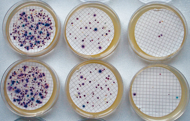
List of articles from – 1/2016

The National Spatial Data Infrastructure and the Reflection on the expected Role of Cartography and GIS Products provided by the T. G. Masaryk Water Research Institute, p.r.i.

The article shows the case of the best practice in the interdisciplinary management of the Spatial Data Set within River Network Section Model based on excellent cooperation of T. G. Masaryk Water Research Institute, p.r.i., with the Czech Office for Surveying, Mapping and Cadastre and the Czech Hydro-meteorological Institute.

Assessment of the relationship between water quality and functions of small water reservoirs

Small water reservoirs are one of the principal elements of agricultural landscape in the Central European context. The monitoring of the quality of aquatic environment of selected ponds and small reservoirs (SWR) in areas of southern and central Moravia and the Vysočina Region was carried out in 2013 to 2015.