infiltration

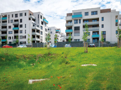
Water infiltration will help with heat, drought, and floods

New predictions of climate change impacts in the Czech Republic show that rainfall will increase slightly in the future. However, in combination with the expected increase in temperature, evaporation will be higher, which will lead to long-term water shortage. Forecasts also say that rainfall will be distributed differently during the year, which in practice means that long periods of drought will alternate with sudden torrential rainfall. But this is nothing new. In the Czech Republic today, there is already a lack of water; it lies on the main European watershed, and we are therefore highly dependent on rainwater. In the past, unfortunately, we have modified cities and the countryside in such a way that rainwater was quickly diverted away – by channelling watercourses, by farming methods, and by creating sewers. Adaptation measures to climate change in the field of water management can significantly increase the sustainability of water resources, reduce the risk of floods, and ensure water even in times of drought.

Groundwater formation in urban areas regarding peripheral parts of Prague

Groundwater is an integral part of the hydrosphere and hydrological cycle in a healthy landscape, which is better able to withstand hydrological extremes such as floods or prolonged drought. The main source of groundwater is precipitation. There are a number of barriers for infiltration in urban areas – urban and industrial buildings, as well as increasing areas with impermeable surfaces. The aim of the paper is to draw attention to the importance of groundwater in the urban landscape and to possible measures to support the infiltration of precipitation.
The research took place in the territory of outer Prague, where there is an intensive expansion of the built-up area, which is accompanied by a lower infiltration of precipitation, compared to the open landscape. Based on the evaluation of pedological, geological and hydrogeological conditions of the area, a methodology for evaluating the suitability of the area for infiltration was developed. Based on it, two types of maps were created: an infiltration potential map evaluating primarily the permeability of the soil and rock environment, and an infiltration capacity map, in addition emphasizing the size of the free storage volume for infiltrated water. Maps are available for viewing in the map application on the project website heis.vuv.cz/projekty/praha-adaptacniopatreni.