agricultural management

The analysis of agricultural landscape development shown on selected cadastral districts in the upper part of the Výrovka River basin

V tomto článku jsou ve vybraných katastrálních územích s převažující plochou zemědělské půdy porovnávány aktuální land use a struktura krajiny s historickým stavem z podkladů Císařských povinných otisků stabilního katastru. Jsou zde nastíněny možnosti využití analýz historického vývoje krajiny ke krajinné obnově v zemědělských oblastech, zejména s ohledem na obnovu mokřadních ekosystémů a revitalizaci vodních toků.

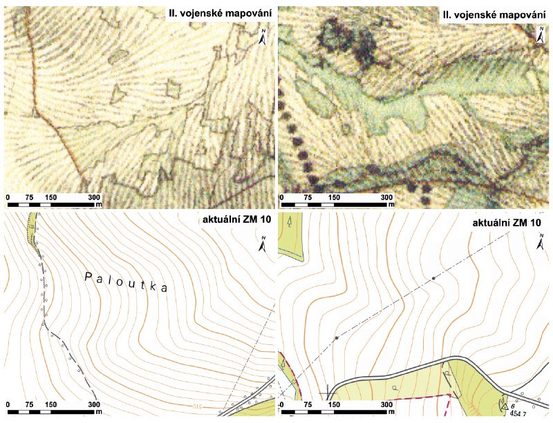
The trajectory of wetlands development in the upper part of the Výrovka river basin over the last 180 years

The article is focused on analysis of the change of wetlands coverage and the representation of various types of wetlands in the upper part of the Výrovka river basin over the last 180 years. The historical maps of the Stable Cadastre, current orthophotographs and GIS layers of actual localization and classification of different types of land cover were used as data sources.