ABSTRACT
This article presents the results of research of the pond landscape development in the lower Doubrava river. The results are based on the interpretation of archival map documents and the current state of the site. On the map of the 1st military mapping (1764–1768), a system of thirteen ponds was recorded on the right bank of the Doubrava river. There were three ponds on the left bank of the Doubrava river. On the map of the 2nd military mapping (1836–1852), only four ponds were recorded on the right bank of the Doubrava river and only two ponds on the left bank of the Doubrava river. Of the historic pond system, only Koukalecký pond and a pond near Žehušice chateau have survived to the present day. On the 1st military mapping map, the total approximate area of the ponds was 449 ha, on the 2nd military mapping map it was 107 ha, and today only 0.91 ha.
INTRODUCTION
Today, Polabí suffers from a lack of groundwater and there is large seasonal desorption of small watercourses, mostly straightened and deepened ones. This problem will most probably worsen in the future due to the expected continued occurrence of extreme climate events. It is therefore necessary to focus on the restoration of landscape elements with a positive effect on the water regime and also on the actual management of water in the landscape.
The main goal of the research, the results of which are presented in this article, was to map the development of the landscape around disappeared ponds in the basins of Labe tributaries in Polabí, based on the interpretation of archival maps, especially with regard to the possible restoration of water-retaining elements in the landscape.
The development of the pond landscape in the Doubrava basin is specifically presented here. This location has already been partially mentioned in an article dealing with landscape changes in selected locations in Polabí with a focus on wetlands, including ponds [1]. The development of the pond system on the lower Doubrava river was also recorded in the assessment of the water management development in the Čáslav region [2] and also the development of the landscape of Nové Dvory and Žehušice municipalities [3, 4]. However, in this article, the development of the pond system on the lower Doubrava river is described in more detail and separately, not as part of the assessment of a larger territorial unit.
LOCATION DESCRIPTION
The disappeared pond system is located in the 1-03-05 Doubrava third order basin in the cadastral areas of Sulovice, Žehušice, Horka u Žehušic, Rohozec u Žehušic, Lišice u Sulovic, Brambory, Bílé Podolí, Zaříčany, Bojmany, and Habrkovice in the Kutná Hora district [5]. The geological bedrock consists of calcareous claystones, marlstones, and clayey limestones [6]; the predominant soil types are chernozem arenic and cambisol arenic; in the Doubrava floodplain it is modal and gley fluvisol [7]. Based on the geomorphological division, the majority of the monitored area is located in the Žehušice basin geomorphological district, which is part of the Central Elbe Table geomorphological unit [8].
METHODOLOGY
The first step was the selection and subsequent comparison of the current and historical state of disappeared pond systems in Polabí, based on map interpretation. The next step was a field survey of these locations to verify their current condition. For the primary detection of the occurrence of ponds, a map from the 1st military mapping was used, which is available as part of the oldmaps application of the Geoinformatics Laboratory of the Faculty of Environment at J. E. Purkyně University in Ústí nad Labem [9].
The current basic map of the Czech Republic 1 : 10,000 (BM 10) and the current Orthophoto map of the Czech Republic were used to show the current state. Both maps are provided as a WMS service from the ČÚZK Geoportal [10]. For a more accurate understanding of the development of the landscape between the state recorded on the map of the 1st military mapping and the current state, a map from the 2nd military mapping was used; this is accessible as a WMS service from the INSPIRE National geoportal [11].
In order to approximate the state of the landscape before the 1st military mapping, especially with regard to the very occurrence of ponds rather than their exact location, the positionally inaccurate map from Müller’s mapping was used, which is most easily accessible on the map browser of the archives of the Land Survey Office [12].
Current maps used
Current BM 10 and Orthophoto map of the Czech Republic
These maps are available as a WMS service from the ČÚZK Geoportal, where they are continuously updated as required. The state shown on BM 10 may differ depending on individual segments that are registered separately (e.g. road network), and therefore may not show the real overall state of the landscape in a given period. The entire Orthophoto map of the Czech Republic is updated in a two-year cycle. Approximately half of Czech Republic is updated annually; from 2020, the region boundaries are taken into account. Currently, both maps should correspond to the state of the landscape in 2021 and 2022 [10].
Archival maps used
Müller’s mapping
The oldest map used here is Müller’s map of Bohemia from 1720 at a scale of approximately 1 : 132,000 [13]. The disadvantage for a detailed comparison of the landscape development with the other maps is its unsatisfactory spatial accuracy. Therefore, Müller’s mapping can only be used to show water bodies (ponds) as a supplement to newer documents. It does not show all watercourses and their outline is not accurate [14].
1st military mapping
The basis of the 1st military mapping was Müller’s map enlarged to a scale of 1 : 28,800. The mapping itself took place in 1764–1768 and then 1780–1783 (revision). It captures Bohemia, Moravia, and Silesia as a whole in the period before the onset of the industrial revolution, at the time of the greatest flourishing of the cultural baroque landscape and its highest diversity [9]. The disadvantage is low spatial accuracy; however, for the initial detection of ponds (water bodies) it is more suitable than the 2nd military mapping map because on the latter most of the pond systems have already disappeared and been replaced by another type of land cover.
2nd military mapping
This is the first relatively positionally accurate map. It was drawn on a scale of 1 : 28,800 in 1836–1852. Its creation was preceded by military triangulation, which was the geodetic basis of this work. The material used were Stable Cadastre maps of Bohemia, Moravia, and Silesia. Compared to the 1st military mapping, accuracy of the map increased. The content of both military mappings is basically the same, but the situation depicted is diametrically different. The 2nd military mapping took place at the onset of the industrial revolution and the development of intensive forms of agriculture; the area of arable land increased by half in 100 years and the forest area reached a historical minimum. The first railway lines are also recorded here [15].
RESULTS
The pond system on the lower Doubrava river lay on the Čertovka watercourse and was fed by a system of canals from the Doubrava river. This system was recorded during the 1st military mapping, including the pond names. There were Bojmanský, Podolský, Bramborský, Horecký, Dvorský, Borecký, Taušek, Světlov, Babický, and Kmotrov ponds. There were also smaller ponds drawn without specifying their names: Koukalecký, and a pond in the village of Horka. On the left bank of the Doubrava river, there were Kravinec and Šibeniční ponds as well as a small pond near Žehušice chateau (Figs. 1 and 4).
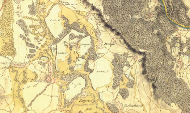
Fig. 1. Pond system in the lower Doubrava river, 1st military mapping
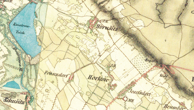
Fig. 2. Kmotrov and Šibeniční ponds in the area of the disappeared pond system on the lower Doubrava river, 2nd military mapping
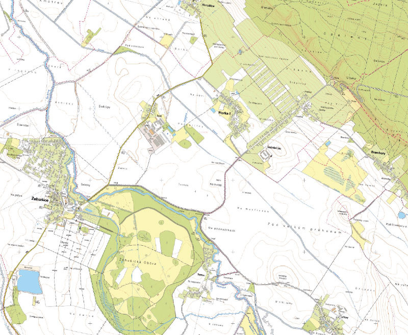
Fig. 3. Current state of the landscape around the disappeared pond system in the lower Doubrava river, current BM 10
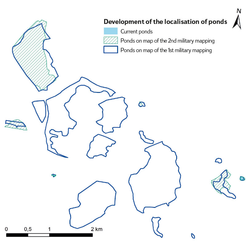
Fig. 4. Changes in the ponds on the lower Doubrava river, from 1st military mapping to the present
On the map of the 2nd military mapping, only Kmotrov pond, Koukalecký pond and the pond in the village of Horka were shown in the pond system. On the left bank of the Doubrava river, Šibeniční pond remained on a significantly larger area, and the pond near Žehušice chateau (Figs. 2 and 4).
Currently, only Koukalecký pond and the pond near Žehušice chateau have been preserved in the studied area, but the latter has a different shape and area size from the state captured on the maps of the 1st and 2nd military mapping. Koukalecký pond is currently a rainwater pond and has no inflow or outflow, although the 1st military mapping shows an inflow and outflow into Podolský pond. The situation recorded in the 2nd military mapping shows Koukalecký pond as it is today, i.e. a rainwater pond (Figs. 1–4). Other water bodies in the studied area are not ponds; they have been created by sand mining or has concreted bottom.
Müller’s map of Bohemia shows a system of five ponds on the Čertovka. These are the Horecký, Borecký, Taušek, Světlov, and Kmotrov ponds. However, the situation on this map is different from the the one from the 1st military mapping; the shape of Světlov and Horecký ponds is very different, and the location is not completely accurate. Also, the Čertovka watercourse is not recorded in full, but only the part located beyond the confluence with the channel that feeds the pond system. This part – including the canal – is drawn as the main watercourse and the Doubrava river is drawn with a faint line. On the left bank of the Doubrava river is shown Kravinec pond (Fig. 5).
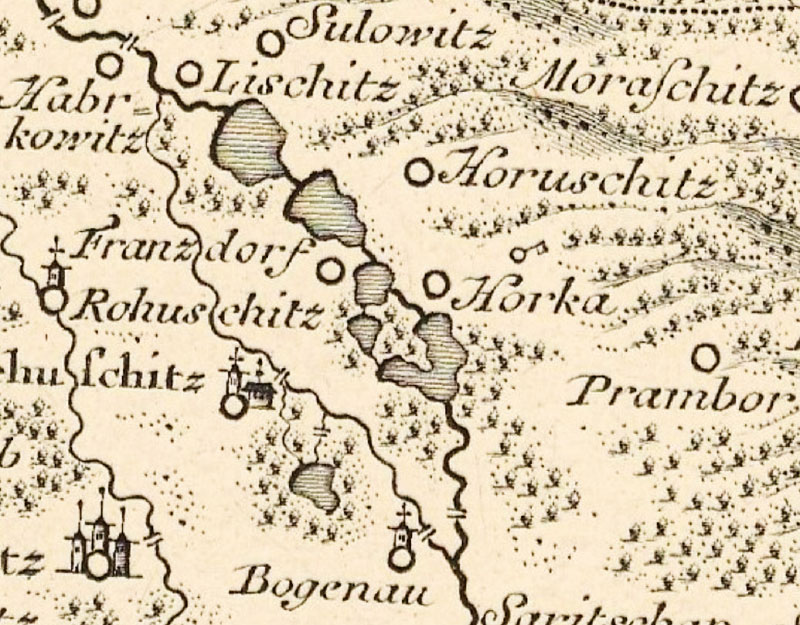
Fig. 5. Pond system on the lower Doubrava river, Müller‘s map of Bohemia
In this site, a total of 16 ponds with a total (approximate) area of 449 ha were recorded on the map of the 1st military mapping. The maximum area of one pond was 116 ha, the minimum 0.25 ha, and the average 28.6 ha. Six ponds with a total area of 107 ha were recorded on the map of the 2nd military mapping. The maximum area of one pond was 87 ha, the minimum 0.15 ha, and the average 17.9 ha. Currently, there are only two water bodies classified as ponds with a total area of 0.91 ha. The area of Koukalecký pond is 0.68 ha, and the pond in Žehušice chateau park is 0.23 ha. The average area of the current pond in this site is therefore 0.46 ha.
At the site of this disappeared pond system today, there is mainly arable land, periodically waterlogged in some places, and to a lesser extent buildings, permanent grassland, small concreted water reservoirs, straightened and deepened watercourses with surrounding greenery (including reeds). The site of the disappeared Kravinec pond is located in the chateau game park, and the pond has been replaced by forest and permanent grassland.
Figs. 6 and 7 compare the current and historical conditions in the Hastrman site behind Bojmanský weir, where the canal began which was used to supply the disappeared pond system, and now returns to the Doubrava river behind the weir. The Imperial Imprint of the Stable Cadastre still show a functional system of canals, although only Kmotrov and Horecký ponds were the only ponds preserved from the pond system shown on the 1st military mapping. Figs. 8 and 9 show the current state in this site, both the overflow for the canal in front of Bojmany weir and the preserved section of the canal for feeding the disappeared pond system, which flows into Starkočský stream.
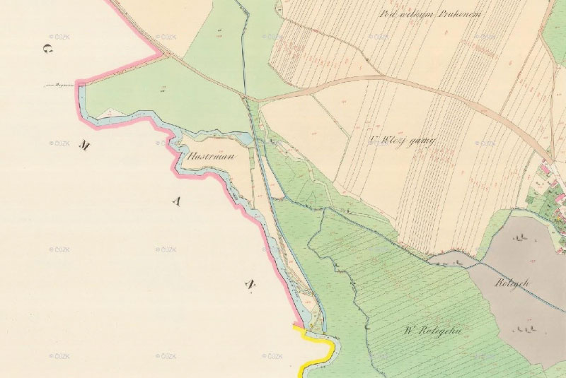
Fig. 6. The Hastrman site on a Imperial Imprint of the Stable Cadastre
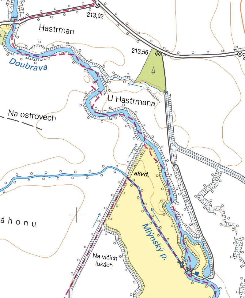
Fig. 7. The Hastrman site on current BM 10
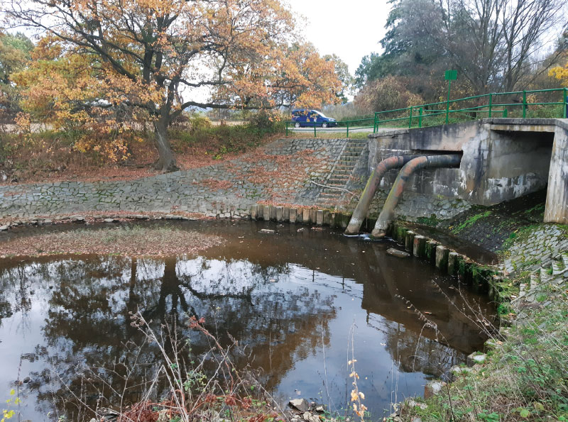
Fig. 8. Current situation below Bojmany weir at the spillway for the riverbed, which was used to supply the disappeared pond system and now returns behind the weir to the Doubrava river (November 2023)
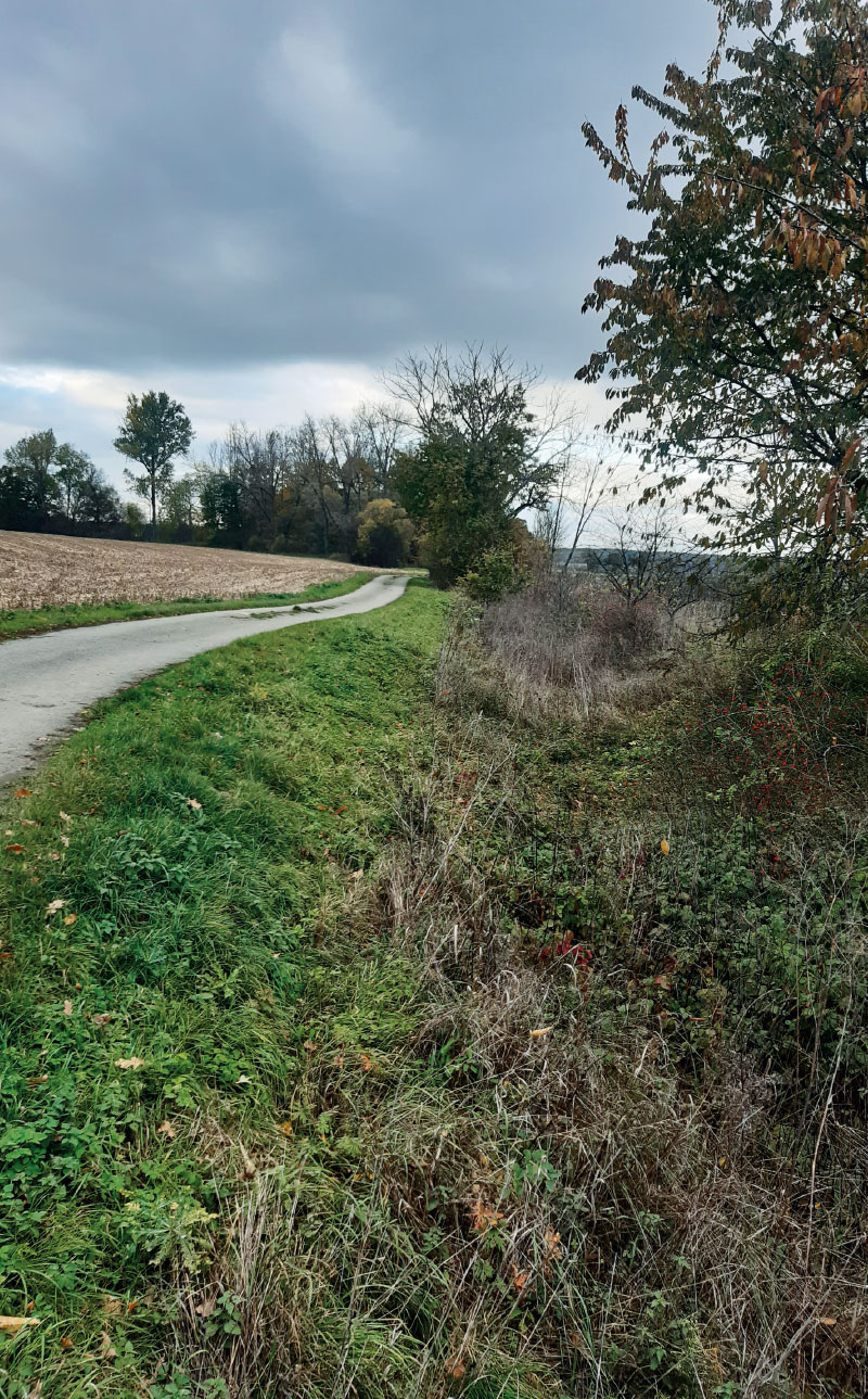
Fig. 9. A preserved riverbed section for the water supply of the disappeared pond system (November 2023), marked as an occasional flow on BM 10
Fig. 10 shows the historic condition of Podolský and Koukalecký ponds, where it is already evident that Koukalecký pond has no inflow and outflow. The current state of Koukalecký pond is shown in Fig. 11. Furthermore, the current landscape in the site of the disappeared Podolský (Fig. 12) and Bramborský ponds (Fig. 13) is shown with successional vegetation including mature trees and reeds. A general view of the current landscape around Koukalecký pond and the disappeared Bramborský and Podolský ponds on the Orthophoto map of the Czech Republic reveals a waterlogged site at the area of the disappeared Podolský pond, and also wetland habitats near both disappeared ponds (Fig. 14).
Fig. 15. shows the current state at the site of the disappeared Horecký pond, including the canalized Zaříčanský stream (November 2023)
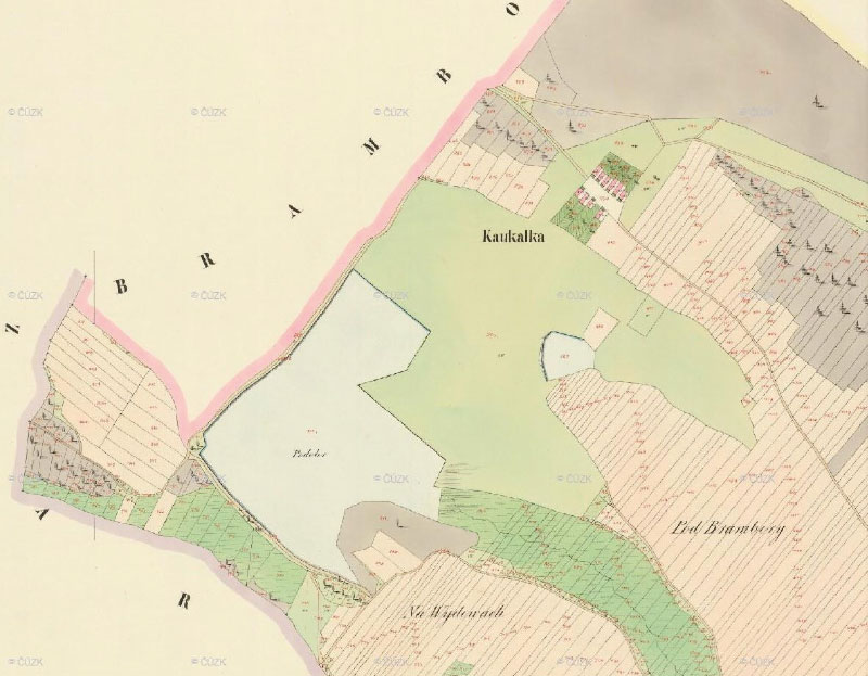
Fig. 10. Podolský and Koukalecký ponds on a Imperial Imprint of the Stable Cadastre
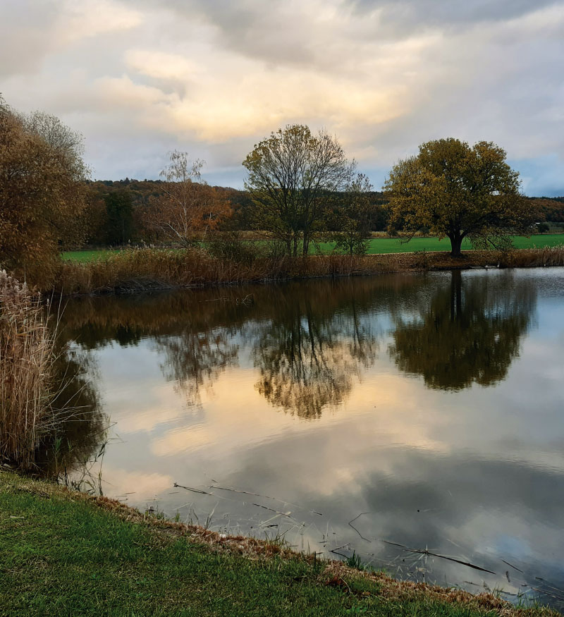
Fig. 11. Current state of Koukalecký pond (November 2023)
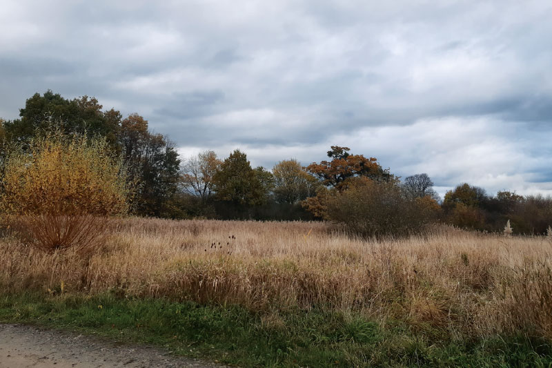
Fig. 12. Current state of the landscape at the site of the disappeared Podolský pond (November 2023)
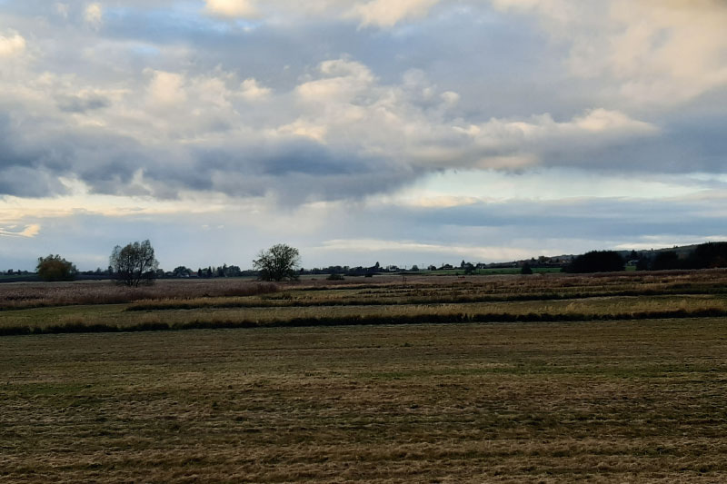
Fig. 13. Current state of the landscape at the site of the disappeared Bramborský pond (November 2023)
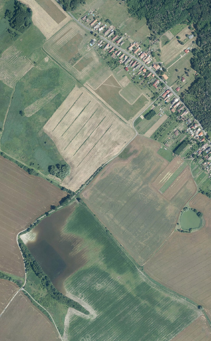
Fig. 14. Current state of the landscape at the site of Koukalecký pond and the disappeared Bramborský and Podolský ponds (waterlogged site in the lower part of the image), current Orthophoto map of the Czech Republic
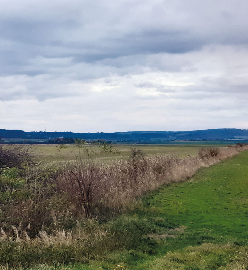
Fig. 15. Current state of the landscape including the Zaříčanský stream at the site of the disappeared Horecký pond (November 2023)
DISCUSSION AND CONCLUSION
For landscape planning, it is advisable to look for inspiration in archival maps and documents. These are applicable in the case of waterlogged sites as the basis for the restoration of ponds, wetlands and springs or for determining (verifying) suitable places to allow succession [16].
The map from the 1st military mapping was taken as a starting point, where the disadvantage is low spatial accuracy. However, for the initial detection of ponds, it is more suitable than the 2nd military mapping because on the latter map, most of the pond systems have already completely or partially disappeared and been replaced by another type of land cover. However, the ponds on the map of the 1st military mapping were very large, with an average area of 28.6 ha, with 5 small ones out of the 16 ponds recorded (less than 1 ha). When determining the location of these ponds, it was possible to start from the location of the preserved ponds from the 2nd military mapping (Kmotrov, Šibeniční, Koukalecký) and also from the current BM 10, where, in addition to the preserved Koukalecký pond, the names of sites reminding of disappeared ponds were used as a guide (Kmotrov, Světlov, Šibeniční, Toušek, Babický, Podolský pond) or the state of the sites regarding their waterlogging, the presence of hygrophilous vegetation, animals, etc. (Na mokřinách, Ve vrbičkách, Žabník, Pod rybníkem, Špatná luka v rybníčku, Na blatinách, Hastrman, U Hastrmana, U luhů, Na ostrovech).
Müller’s map of Bohemia shows a system of five ponds on the Čertovka, while on the map of the 1st military mapping there are seven of them on the Čertovka, with two of them being smaller areas. However, the drawing of the shape of the ponds on the Müller’s map differs from the drawing from the 1st military mapping, and the spatial location is not completely accurate. Considering these differences in the method of mapping, it is not possible to infer from these sources whether Koukalecký pond (which is shown on the 1st military mapping and has survived to the present day) had not yet been built at the time of Müller’s mapping. The pond system on the Čertovka has a feeding channel from the the Doubrava river, which returns back to the river, recorded on both maps. However, on Müller’s mapping, the Čertovka is shown as the main watercourse, while on the map of the 1st military mapping it is the Doubrava river. On the map of the 2nd military mapping, as well as the maps of the Stable Cadastre, the Doubrava river is also clearly the main watercourse. At the time of Müller’s mapping, either the Čertovka could have appeared more watery due to the supply of the pond system, or it is a faulty drawing, which is not unusual regarding watercourses on this mapping.
The development of the pond system on the lower Doubrava river was also recorded in the assessment of the water management development in the Čáslav region [2]. However, this site was not dealt with separately and in detail, but as part of the classification of the water management development (ponds, mills, dams, floodplains, etc.) in the territory of the Čáslav municipality (a municipality with extended administration; ORP). The pond system described in this paper is located on the northeastern edge of this ORP.
Furthermore, the development of water bodies was also investigated as part of the assessment of the landscape development of Nové Dvory and Žehušice municipalities [3, 4]. This was primarily about the implementation of the European Landscape Convention at the local level in the form of a pilot study in the area of Nové Dvory – Kačina – Žehušice, which represents a segment of intensively agriculturally used landscape with a persistent significant trace of baroque and classicist landscaping. The subject of the study was primarily the development of a strategy and effective procedures to ensure sustainable development of the landscape, respecting both its economic potential and the protection and development of its natural and cultural-historical values. The main output of the project was the individual scenarios of landscape development based on the combination of degrees of anthropogenic use of the landscape and degrees of its protection. One of the inputs was the depiction of the historical form of the studied area based on the interpretation of archival maps. The area covered consisted of 21 cadastral areas, of which Sulovice, Žehušice, Horka u Žehušic, Rohozec u Žehušic, Lišice u Sulovic, Zaříčany, Bojmany, and Habrkovice are part of the territory assessed in this article [17].
Disappeared ponds based on the interpretation of archival maps were studied by David [18]. These were the areas of Blatná, Třeboň, Blaník, and Kouřim. Havlíček et al. dealt with the restoration potential of water bodies recorded on the map of the 1st military mapping [19]. Based on the analysis of three basins (Bystřice, Jevišovka, Opava), it was found that the greatest potential for restoration of water bodies from this period is in the Jevišovka basin, where a preserved dam or a larger part of it was recorded in 51 % of disappeared water bodies. The other two basins show less potential for the restoration of disappeared water bodies: 26 % for the Opava and 24 % for the Bystřice. In the studied area of the disappeared pond system on the lower Doubrava and Čertovka rivers, preserved dams can also be seen by the main ponds in the landscape. However, the restoration of the ponds to their original size is not possible because part of their area is already built-up, or development has spread to the immediate vicinity of the historical location of the ponds. In addition, the site of the disappeared Kravinec pond is located on the territory of the Žehušická obora natural monument. However, according to extant reports, these vast disappeared ponds were mostly shallow and very muddy, forming swamps [2, 20].
If we only take into account the current state of the landscape, the site of the disappeared pond system on the lower Doubrava river and the Čertovka would be suitable for building small wetlands (ponds, pools, wet meadows), in particular on small, waterlogged sites in the place of today’s arable land, whether they are waterlogged, or with reeds. On the site of the former ponds are fertile soil types; however, if the crop sown on a waterlogged site does not grow and is eventually replaced by reeds, it would be appropriate to use this fact for the restoration of wetland habitats as stable water-retaining elements in the landscape. In areas with already restored wetland vegetation, it would be useful to establish some territorial protection.
The results presented here could be a practical guide for building small water reservoirs (ponds) and other wetland habitats (wet meadows) in place of the disappeared ones, as the historical location of such elements is a very strong argument for their restoration. These landscape elements are also part of the solution for adaptation to the issues caused by climate change. In the case of landscape restoration in the places of disappeared ponds and other wetland sites, both water retention and landscape biodiversity increase. This fact is in line with the EU Biodiversity Strategy 2030 [21], which is a valid long-term plan to protect wildlife, stop ecosystem degradation, and restore biodiversity in Europe.
Acknowledgements
The article was created within the framework of TGM WRI internal grant No. 3600.54.03/2022 “Water in the landscape as an indicator of territory changes in Polabí” and within the research of the Centre for Landscape and Biodiversity (project SS02030018, supported by the Technology Agency of the Czech Republic).
The Czech version of this article was peer-reviewed, the English version was translated from the Czech original by Environmental Translation Ltd.
