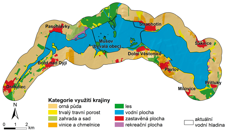
Changes in land use due to the construction of water reservoirs
This paper deals impacts of building of water reservoirs on land use changes in floodplains and adjacent areas of three reservoirs in southern Moravia – Nové Mlýny, Vranov, Brno. To monitor the development of land use the old topographic maps were used.