The Ore Mountains triangle formed by the towns of Abertamy, Boží Dar, and Horní Blatná is not only a tourist and skiing paradise, but also part of the Erzgebirge/Krušnohoří Mining Region, inscribed on the UNESCO World Heritage List since 2019. It is located in western Bohemia in the Karlovy Vary District, near the state border with Saxony in Germany (see map in Fig. 1). The area consists essentially of three ore mining districts combined into a single region, characterised by a range of urban and landscape heritage features, led by the historic centres of all three towns (e.g., the Church of the Fourteen Holy Helpers in Abertamy from 1534, Fig. 2).
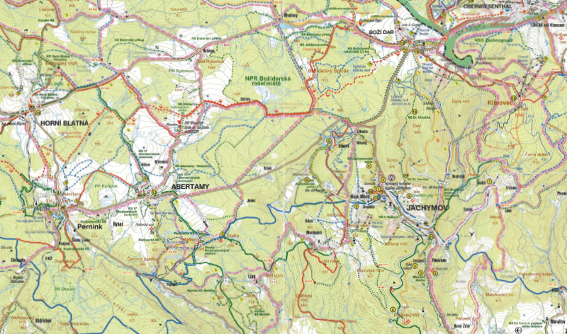
Fig. 1. Map of Boží Dar Peat Bog and its immediate surroundings
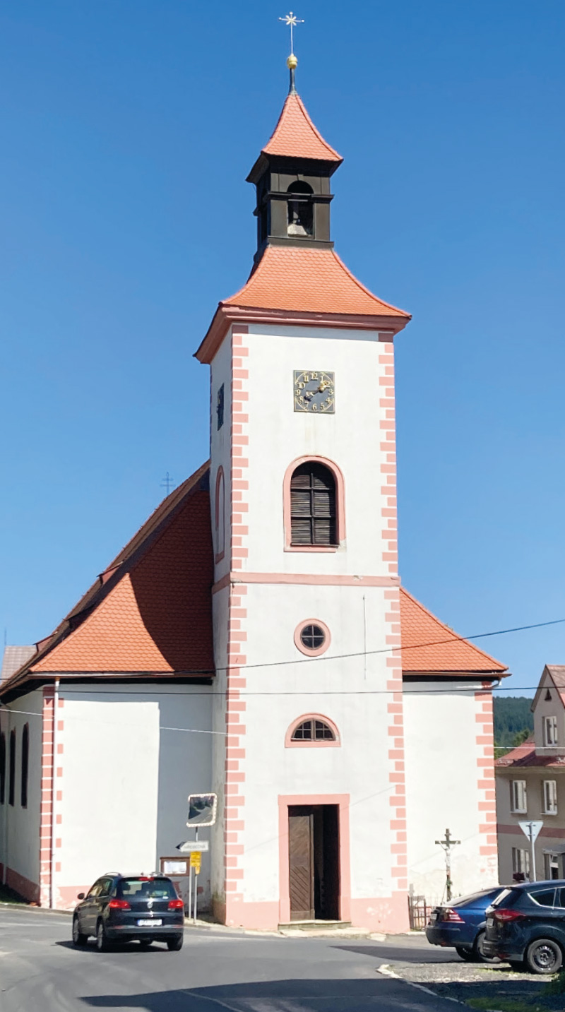
Fig. 2. Church of the Fourteen Holy Helpers in Abertamy
Nature reserve
A highly significant and inspiring part of this area is Boží Dar Peat Bog National Nature Reserve (Fig. 3). It is located west of Boží Dar on a plateau near Božídarský Špičák, the highest basalt dome in Central Europe (1,115 m a.s.l.; Fig. 4). Covering an area of approximately 930 ha, it is one of the important protected areas in the Czech Republic. Its value in terms of nature conservation is best demonstrated by the fact that in 2008 it was designated as a Wetland of International Importance under the Ramsar Convention. It is also part of Ore Mountains Plateau Site of Community Importance within the Natura 2000 network.
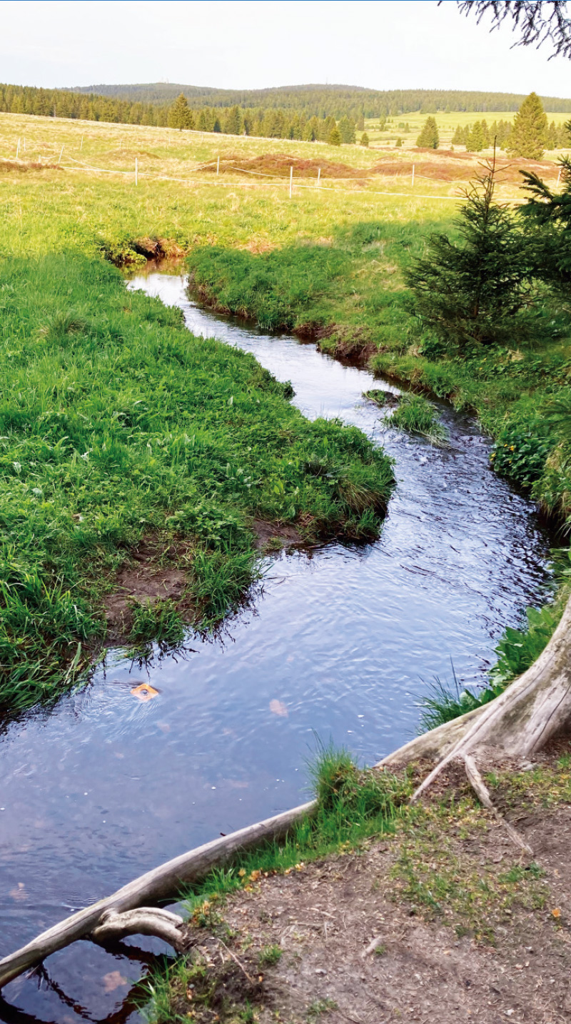
Fig. 3. Boží Dar Peat Bog
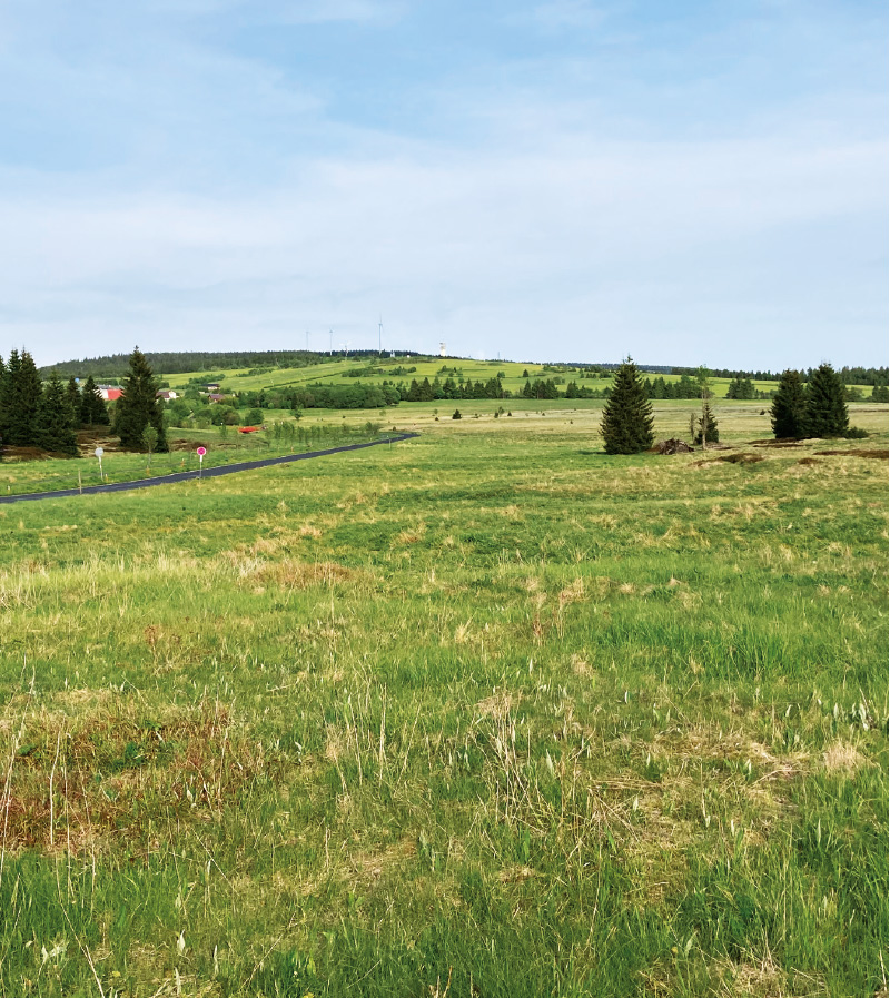
Fig. 4. The nature reserve is situated on a plateau
Among the watercourses, the most important for the peat bog are the Černá stream, which rises here at the northern edge, the Božídarský stream, and their small tributaries (Fig. 5). In the southern part lies Mrtvý pond, characteristic for its dark colour caused by the presence of peat. Since the 16th century, it served the needs of mining operations. Blatenský Water Ditch also originates in Boží Dar Peat Bog (Fig. 6). This is a unique technical structure built between 1540 and 1544, which supplied water to local tin and iron mines and also functioned as a navigation canal for timber transport. The ditch ran from the peat bog via Myslivny and Ryžovna to Bludná and around Blatenský hill to Horní Blatná, where it was piped and led into the Blatenský stream. Even after mining ceased in the 19th century, its use did not end – it became a source of water for local mills, sawmills, and paper mills, as well as for fire protection; indeed, it remains in operation to this day. It is approximately 12 km long and is accompanied by an educational trail of the same name with 23 stops. Blatenský Water Ditch is an excellent example of the high level of technical and logistical cooperation between the mining industry and water management in this Ore Mountains region as early as the 16th century. In 2017, it was designated a National Cultural Monument.
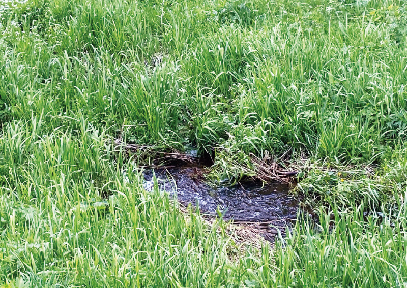
Fig. 5. The landscape is interwoven with numerous small streams
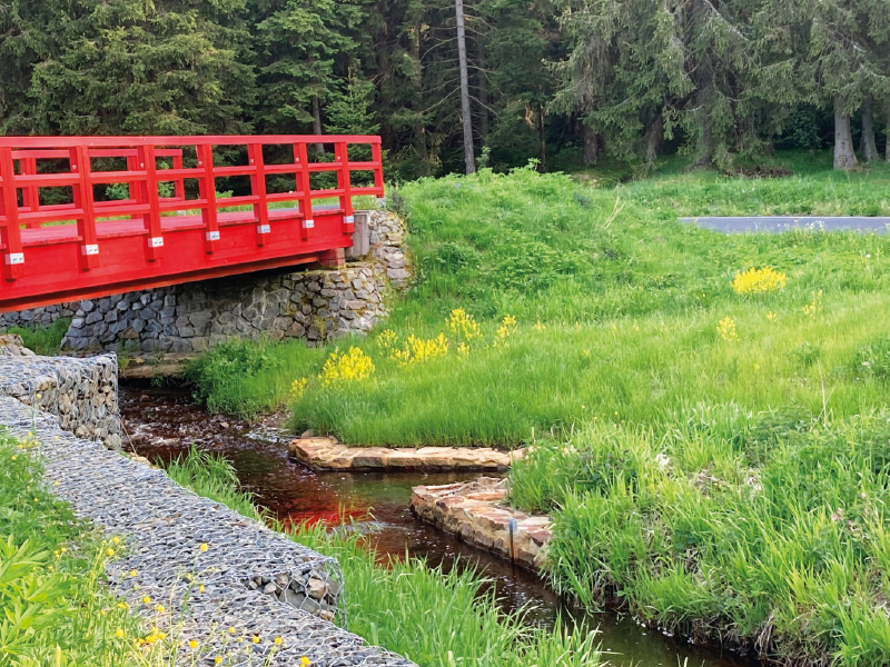
Fig. 6. Blatenský Water Ditch with a newly repaired footbridge (June 2025)
History of the area
Boží Dar (1,028 m a.s.l.), the highest town in the Czech Republic and in Central Europe, with a current population of around 260 inhabitants, was founded as early as 1533 by the Saxon Elector John Frederick I, who is still depicted in one of the town’s symbols – the famous mountain Green Hotel (Fig. 7) from 1542 – in a wall painting.
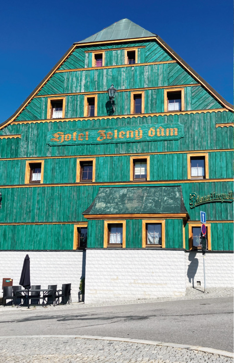
Fig. 7. Zelený dům Hotel in Boží Dar
The three ore mining districts mentioned above (Horní Blatná, Hřebečná, and Bludná), with their numerous surface and underground remains of mining activity, still provide exceptional evidence of various methods of extracting tin, as well as iron, copper, and other ores from steep greisen veins (quartz veins in strongly metamorphosed granitic rock, typical of the Blatná granite massif; author’s note) over a period of more than 400 years, from the 16th to the 20th century. Illustrative examples include the former tin mines of Vlčí and Ledová jáma on Blatenský hill and Zuzana mine in the nearby Bludná district. Even larger is the collapse depression of Červená jáma mine between Bludná and Hřebečná. The well-preserved Mauritius mine in Hřebečná, now a National Cultural Monument, features the 400 m long Kryštof adit, which is open to the public and offers the opportunity to view traces of manual excavation using hammer and chisel, as well as rock fractured by heat from the fire-setting technique.
Of a completely different type is the Zlatý Kopec deposit (originally called Kaff), located on a steep slope above the Zlatý stream on the edge of Boží Dar. The largest mine in this district was Johannes mine from the 16th century, which was used to extract polymetallic ores of tin, iron, and copper from flat-lying skarn bodies (formations metamorphosed at the contact of limestones and magma into silicate rocks, which are rich sources of these ores; author’s note). It operated for almost 400 years with only minor interruptions.
The extraction of tin ores was also linked to the establishment of the town of Horní Blatná, which is the only example of a mining town in the Ore Mountains that was deliberately founded in the 16th century on previously undeveloped land for the extraction of ores other than silver.
Sejpy – a unique feature of the mining landscape
Deep mining of tin ores in many parts of the Abertamy – Boží Dar – Horní Blatná mining landscape was preceded by the washing of cassiterite from alluvial deposits of watercourses, especially the Božídarský stream, the Černá stream, and its unnamed tributaries in the highest parts of the Ore Mountains. Hundreds of small mounds and depressions near Boží Dar and below Blatenský hill testify to the enormous extent of the washing of tin ore grains – cassiterite (tin dioxide, SnO₂). The main period of alluvial mining of tin dates to the 16th to 18th centuries; however, it certainly took place even earlier, before the founding of Boží Dar in 1533, as Mathesius’s chronicle of Jáchymov from 1562 already describes some of the mining mounds as overgrown with tall trees (information from the Boží Dar Peat Bog educational trail; author’s note).
These mining mounds, also known as sejpy (from the German seifen = to pan), are composed of sands and gravels and fragments of rocks from the surrounding area, mainly schists and phyllites, as well as rounded fragments of Tertiary volcanic rocks; irregular grains of quartz, mica, and feldspar are also ubiquitous. A distinctive feature of the Boží Dar sejpy is the presence of gold flakes, i.e. small particles of gold.
Although gold has never been mined in the Ore Mountains (unlike silver, tin, copper, cobalt, and iron ores) and no primary deposits are known, small and therefore non-economic quantities of gold flakes have always been found here during panning. Their occurrence has not yet been scientifically explained; they are probably already present in greisen veins and are subsequently concentrated in local alluvial deposits through transport and natural processes such as weathering and sedimentation.
Individual sejpy are typically rounded mounds five to ten metres in length, with heights at their crests exceeding two metres. The greatest concentration occurs around the Černá stream above the former Nový Mill, near the so-called Hubertky area, and along an unnamed stream at the eastern edge of Boží Dar Peat Bog. Numerous remains of former panning sites can also be found further downstream along the Černá near Myslivny, Ryžovna, and other locations. The total area covered by sejpy in the vicinity of Boží Dar exceeds 250,000 m², placing them among the largest in the Ore Mountains as well as in the Czech Republic as a whole (for completeness, it should be noted that sejpy can also be found, for example, in the Šumava Mountains near Kvilda; there, however, they are associated with gold rather than tin panning; author’s note).
Since 2013, the historic sejpy near Boží Dar have been protected as a cultural monument of the Czech Republic.
Unique vegetation
The reason for the strict protection of this area is not only the wetland itself as a source of moisture for the landscape and its specific microclimate, but also the local flora and fauna. As the most fertile humus layer was washed away during panning, the sejpy are very poor in nutrients. They therefore differ markedly from surrounding sites in the vegetation that grows on them. A particularly interesting feature is that their individual elements – mounds and depressions – also differ from one another. While the mining mounds, with their distinctive vegetation, resemble northern flora, the depressions between them retain more moisture, allowing characteristic wetland plants to grow there, such as clubmosses and the carnivorous round-leaved sundew.
In terms of forest vegetation, the sejpy are characterised by stunted spruce stands and dwarf pine, as well as dwarf birch and mountain pine; among plants, there are communities of heather, cowberry, mountain everlasting, red fescue, and red campion (Fig. 8). Wild pansy also thrives here (Fig. 9). Among protected herbaceous plants, one can find mountain arnica, bog bilberry, crowberry, and others.
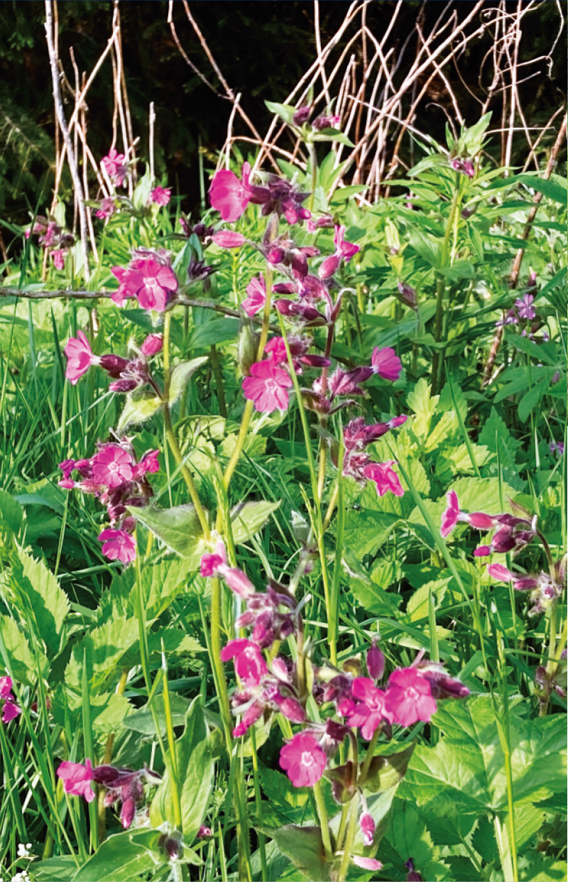
Fig. 8. Red campion
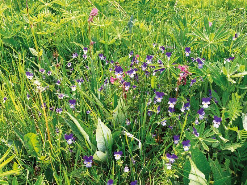
Fig. 9. Wild pansy
A characteristic species is also hare’s-tail cottongrass (Eriophorum vaginatum) (Fig. 10), a member of the sedge family, for which the local acidic peat soils and higher elevation are well suited. After flowering, it is easily recognised by its white cotton-like tufts, which are carried across the landscape and readily dispersed. In the past, these white fluffy fibres were often used for making wadding and even paper. At the same time, hare’s-tail cottongrass contributes to the formation of peat, which was once extensively extracted from Boží Dar Peat Bog for use in nearby spa facilities.
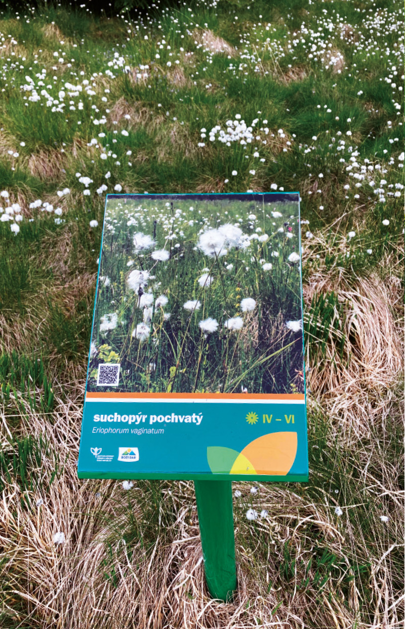
Fig. 10. Hare’s-tail cottongrass is an important species for the peatland
The local fauna is particularly rich in numerous species of insects and songbirds, but one may also encounter the common adder as well as various species of lizards and newts.
Educational trails
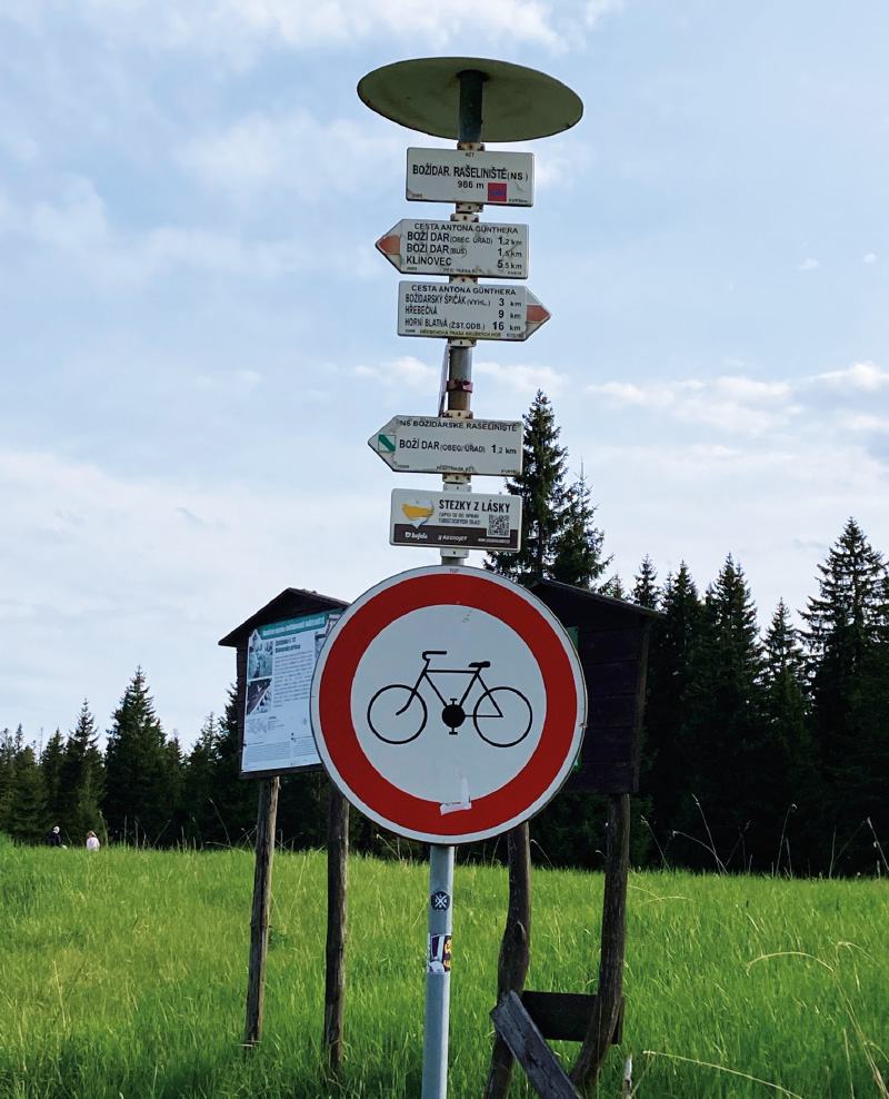
The landscape of Boží Dar Peat Bog is interwoven not only with numerous adits, mines, and collapse depressions, but also with several educational trails. These are mostly of an informative and educational nature. In addition to the above-mentioned trail along Blatenský Water Ditch, there is also, in the northern part, the Tin Trail (German Zinnweg) from Boží Dar to Ryžovna, bearing the logo “Ahoj sousede” (Hello neighbour), which was created as a symbol of cross-border cooperation between the Czech Republic and Saxony within the European Regional Development Fund. The main objective of this project was the preservation, protection, and development of natural and cultural heritage, as well as the improvement of tourist infrastructure in the Central Ore Mountains region.

A circular educational trail of the same name runs directly through Boží Dar Peat Bog. It was established as early as 1972 with the construction of a boardwalk leading through part of the peat bog. Between 2009 and 2011, the trail underwent a technically and financially demanding reconstruction, 85 % of which was co-financed by the European Union – namely the European Regional Development Fund. The trail is now 2.3 km long and features 12 numbered stops with well-prepared information on the history of the area, its flora and fauna, and many other points of interest (Fig. 11). The new boardwalk is built of solid oak timber and, compared to the original, has been widened for visitor safety. As the Boží Dar Peat Bog trail passes through its most valuable part, it is strictly forbidden to leave the boardwalk and enter the surrounding landscape.
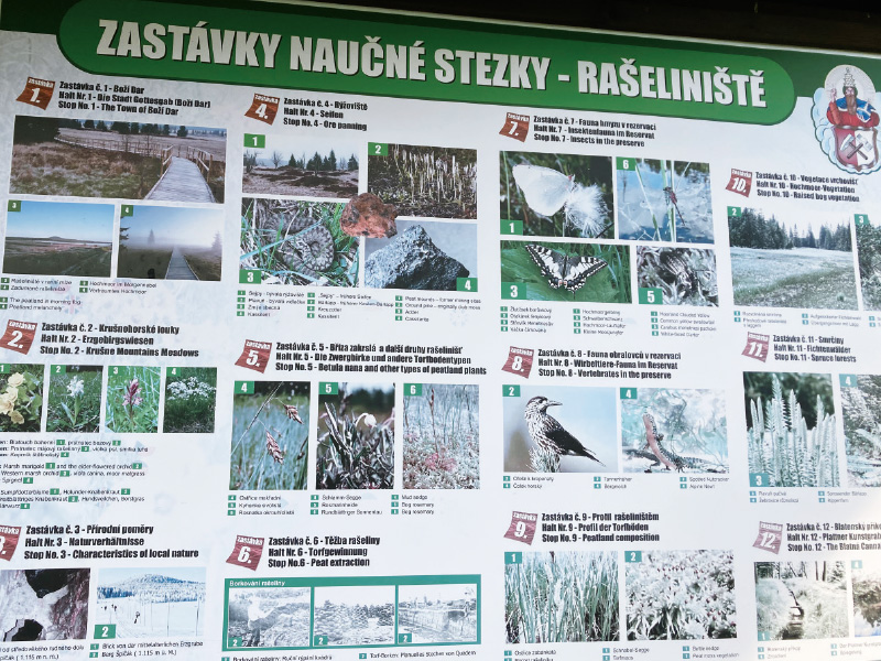
Fig. 11. The educational trail provides much useful information about Boží Dar Peat Bog
Of a completely different character is the so-called Ježíšek Trail, which has two circuits (5.6 km and 12.9 km), with the longer route leading around the entire peat bog, allowing it to be joined from the Boží Dar Peat Bog trail. The Ježíšek Trail begins in the town of Boží Dar, and its stops in the field are easily recognisable thanks to small wooden figures (the same symbol is also placed in front of the post office in Boží Dar, where the so-called Ježíšek Post Office operates; author’s note; see Fig. 12). This recreational trail is primarily intended for families with children, for whom maps and activity booklets with tasks can be obtained at the information centre in Boží Dar; children complete the tasks and record their answers at individual stations. In addition to its playful character, the trail also has an educational function, with an emphasis on nature conservation from an early age. The unique Boží Dar Peat Bog, with its rich history and rare vegetation, undoubtedly deserves protection and respect.
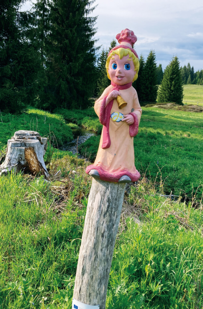
Fig. 12. This wooden statue is a symbol of the Ježíšek Trail
Sources and acknowledgements
All information used in this article, apart from personal observations and conversations with local residents, is derived primarily from maps, guidebooks, and booklets obtained from information centres and hotel receptions, as well as from the information panels of the individual educational trails that I visited during my travels in the Ore Mountains in August 2024 and June 2025. Special thanks are due to Mr Radovan Přiklopil from the reception of the Radium Palace Hotel in Jáchymov, who kindly provided me with many useful maps and sources of information.
An informative article that is not subject to peer review.
