Current Issue

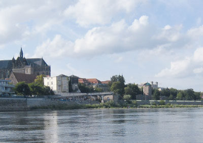
Comparison of the quality of thalweg lines extracted from data of DMR 4G, DMR 5G and its derivatives

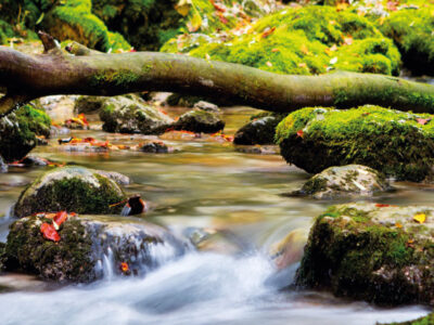
ABSTRACT Determining the gradient of watercourses in the case of local applications is a common problem, which is most often dealt with by geodetic surveying. However, determining the gradient of all watercourses in the Czech Republic is a challenge. The use of geodetic methods on such a scale is usually unrealistic. Therefore, it is necessary to choose a different approach, such as the extraction of the gradient lines from other already existing elevation data. The DMR 4G and DMR 5G are elevation models currently… Read more »

Disappeared pond system in the lower Doubrava river

This article presents the results of research of the pond landscape development in the lower Doubrava river. The results are based on the interpretation of archival map documents and the current state of the site. On the map of the 1st military mapping (1764–1768), a system of thirteen ponds was recorded on the right bank of the Doubrava river. There were three ponds on the left bank of the Doubrava river. On the map of the 2nd military mapping (1836–1852), only four ponds were recorded on the right bank of the Doubrava river and only two ponds on the left bank of the Doubrava river. Of the historic pond system, only Koukalecký pond and a pond near Žehušice chateau have survived to the present day. On the 1st military mapping map, the total approximate area of the ponds was 449 ha, on the 2nd military mapping map it was 107 ha, and today only 0.91 ha.

QFIELD – mobile application for data collection established on the principles of open source software

Acquisition of primary spatial data (geodata) in the form of a field survey (i.e. direct contact of the surveyor with the observed object or phenomenon of the real world) can undoubtedly be described as the most demanding method of their acquisition in terms of time and financial costs. However, in the past ten years, there has been a sharp turnaround in the field of mobile mapping. With the introduction of smartphones and laptops (tablets), countless applications for field data collection have been developed. Combined with Open Source tools, mobile data collection activities have become widely available to both professionals as well as the general public. One of these applications is QField. It is a multi-platform mobile GIS designed primarily for Google Android, Apple iOS, and Microsoft Windows platforms. Its user interface is strikingly similar to that of the QGIS desktop app, giving the false impression that the mobile app is part of it. However, it is stand-alone software developed by an Open Source solutions group, OPENGIS.ch, whose compatibility with the desktop application is ensured by another element, a plugin.

Weisshuhn flume in Žimrovice

The CHMI Ostrava branch has repeatedly had the opportunity to measure water flumes, mostly during verification measurements of minimum residual flows, measurements for structural wear, or revision of flow measurement curves. As part of these measurements, it was a very valuable experience to get to know these undoubtedly very interesting waterworks, which are often also technical monuments. Part of these activities includ-ed measurements and subsequent modelling of Weisshuhn flume in Žimrovice. This article summarizes and comments on the partial results of these activities. One of the tasks was to determine the critical points in terms of water losses in the Weisshuhn flume. Although these phenomena do occur, the numbers are not significant, as illustrated by the results of measurements and modelling. Different types of devices were used for the measurements; mostly ADCP devices, namely RDITeledyne StreamPro, SonTek RiverSurveyor M9, and SonTek Teledyne RS5. MIKE 11.

Interview with Ing. Petr Kazda, Director of Partnership Environmental Foundation

Do you know Tree of the Year, Planting for the Future, and the Adapterra Awards? And do you know what an Open Garden is? Do you use Greenways? All this and much more is related to the Partnership Environmental Foundation in Brno, whose director since 2019 has been Ing. Petr Kazda. Why is climate change a challenge for him that can bring us new opportunities?

Water infiltration will help with heat, drought, and floods

New predictions of climate change impacts in the Czech Republic show that rainfall will increase slightly in the future. However, in combination with the expected increase in temperature, evaporation will be higher, which will lead to long-term water shortage. Forecasts also say that rainfall will be distributed differently during the year, which in practice means that long periods of drought will alternate with sudden torrential rainfall. But this is nothing new. In the Czech Republic today, there is already a lack of water; it lies on the main European watershed, and we are therefore highly dependent on rainwater. In the past, unfortunately, we have modified cities and the countryside in such a way that rainwater was quickly diverted away – by channelling watercourses, by farming methods, and by creating sewers. Adaptation measures to climate change in the field of water management can significantly increase the sustainability of water resources, reduce the risk of floods, and ensure water even in times of drought.

Watermills and windmills as a meeting place

There were many attempts in the past to establish a holiday of Czech mills, which could be related to the holiday of St. John of Nepomuk or even lesser-known saints such as St. Senan or St. Vinok. Therefore, our colleagues Rudolf Šimek (for watermills) and Jan Doubek (for windmills) agreed to organize a joint event for the anniversary of the creation of the legendary mill emblem on 13th May 1116. They also invited archivist and molinologist Jan Škoda to cooperate and approached the owners of several mills to see if they would support the event. There was a wave of very positive reactions, so they decided to organize a big event called Mill Open Day, which will take place on Saturday 11th May this year.

The Czech Republic chairs the International Commission for the Protection of the Elbe River for the next three years

In Magdeburg on 16th January 2024, the handover ceremony took place of the presidency of the International Commission for the Protection of the Elbe River (ICPER). The Czech Republic took over from the Federal Republic of Germany for the next three years. Ing Tomáš Fojtík, who is Director of T. G. Masaryk Water Research Institute (TGM WRI), was appointed as the new president with the agreement of the contracting parties. The TGM WRI employees are internationally recognized and long-term leaders, spokespeople, and members of working groups and expert groups, who significantly participate in the Commission’s activities and direction. This fact underlines the significance and importance of this re-search organization of the Ministry of the Environment as well as the actual research. Since the ICPER establishment in 1990, Ing. Tomáš Fojtík is the fifth president of the Commission from the Czech Republic.